

Batanes still under Signal No. 2 as Siony moves over Bashi Channel
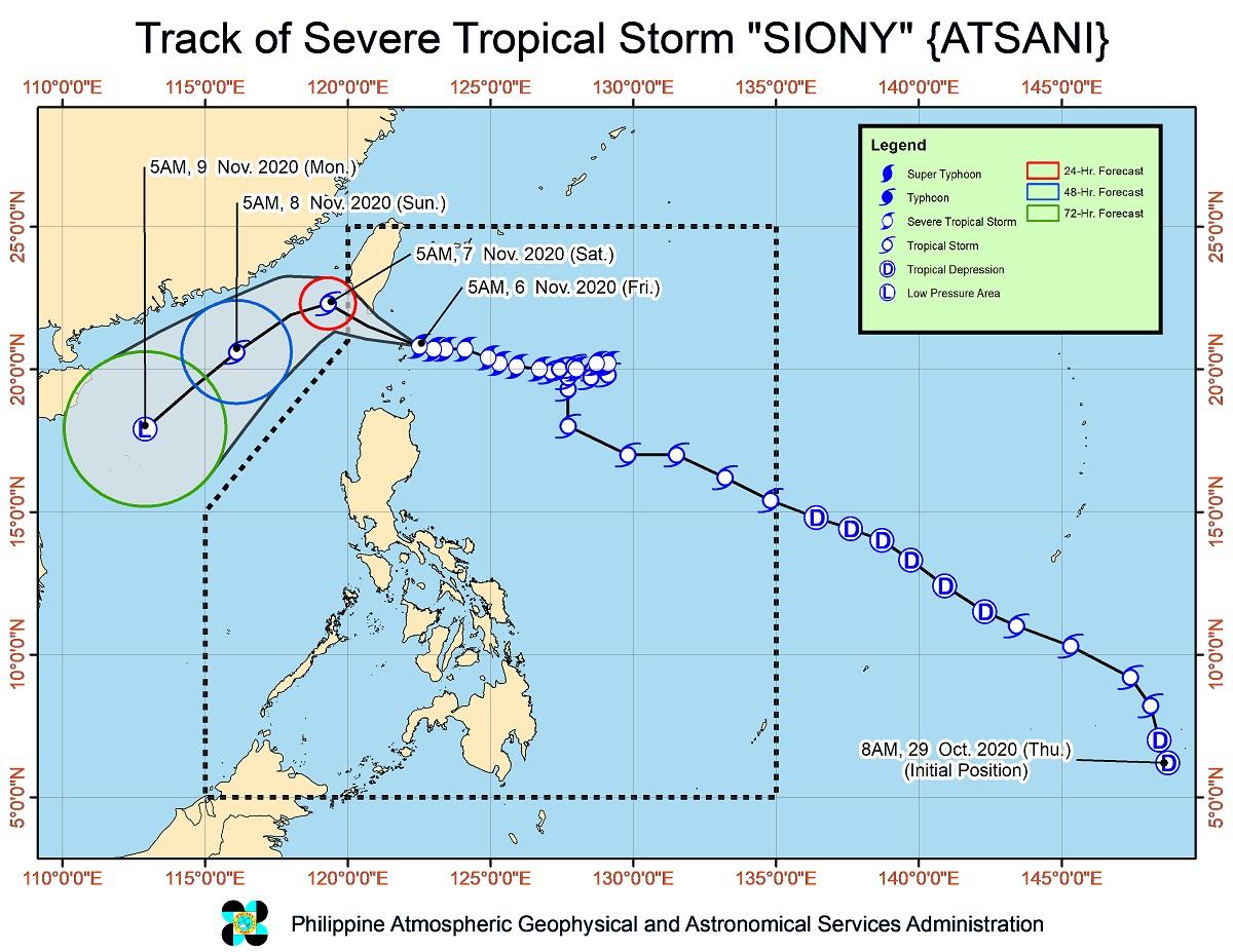
Tropical Cyclone Wind Signal No. 2 remains hoisted over Batanes province as Severe Tropical Storm Siony now moves west-northwestward while maintaining its strength over the Bashi Channel, PAGASA said in its 2 p.m. bulletin.
Tropical Cyclone Wind Signal No. 1, meanwhile, remains hoisted over Babuyan Islands.
According to PAGASA, Batanes is currently experiencing damaging gale- to storm-force winds, while Babuyan Islands is experiencing strong breeze to near gale conditions.
Light to moderate with at times heavy rains are also expected over the Batanes and Babuyan Islands, where flooding (including flashfloods) and rain-induced landslides may occur during heavy or prolonged rainfall, especially in areas identified in geohazard maps as highly or very highly susceptible to the said hazards.
PAGASA said there remains a minimal to moderate risk of storm surge of up to 2.0 m over the coastal areas of Batanes and Babuyan Islands in the next 24 hours.
As of 1 p.m. on Friday, the center of Siony was estimated based on all available data at 95 km northwest of Itbayat, Batanes. It is moving west northwestward at 20 kph, with maximum sustained winds of 95 kph near the center and gustiness of up to 115 kph.
Based on its forecast track, Siony is expected to move west-northwestward and pass over the sea off the southern coast of Taiwan within 12 hours. It is forecast to exit the Philippine Area of Responsibility (PAR) on Friday night.
Aside from Siony, a Low Pressure Area outside the PAR was estimated at 1,075 km east of Mindanao.
The LPA is forecast to move generally west-northwestward or northwestward and may enter the PAR on Friday afternoon.
It is heading towards the direction of Eastern Visayas and may likely reach the area on Saturday afternoon or evening, which may develop into Tropical Depression Tonyo within the next 48 hours. —KBK, GMA News
