

Storm signals lifted as Tonyo maintains strength over West Philippine Sea
Tropical Cyclone Wind Signals across the country were lifted late Sunday afternoon as Tropical Depression Tonyo maintained its strength over the West Philippine Sea.
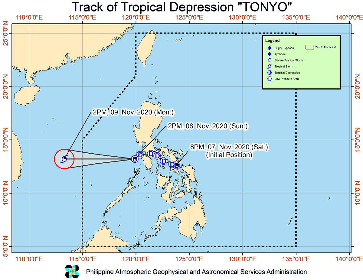
In its 5 p.m. bulletin, state weather bureau PAGASA said the center of the cyclone was last seen 185 kilometers west of Calapan City, Oriental Mindoro carrying maximum sustained winds of 45 kilometers per hour (kph) and gustiness of up to 55 kph.
Tonyo is moving southwestward at 25 kph.
The cyclone remains forecast to intensify into a tropical storm within the next 24 hours and exit the Philippine Area of Responsibility on Monday morning.
Hazards
PAGASA said Tonyo will bring light to moderate with at times heavy rains over Ilocos Region, Cordillera Administrative Region, Cagayan Valley, Aurora, and Palawan, including the Calamian and Kalayaan Islands.
The Northeast Monsoon was also expected to cause strong winds to near gale conditions over Batanes, Babuyan Islands, Ilocos Norte, Apayao, and the northern portion of mainland Cagayan.
The monsoon will also bring rough to very rough seas over the seaboards of Batanes, Ilocos Norte, and Ilocos Sur, as well as over the northern seaboard of Cagayan including Babuyan Islands.
Moderate to rough seas should also be expected over the eastern seaboards of Cagayan Valley, Aurora, and the northern portion of Quezon, and the northern and eastern seaboards of Catanduanes.
“Mariners of small seacraft are advised to take precautionary measures when venturing out to sea. Inexperienced mariners should avoid navigating in these conditions,” PAGASA said. — Julia Mari Ornedo/BM, GMA News
