

Signal No. 1 still up over Kalayaan Islands as Vicky moves to exit PAR
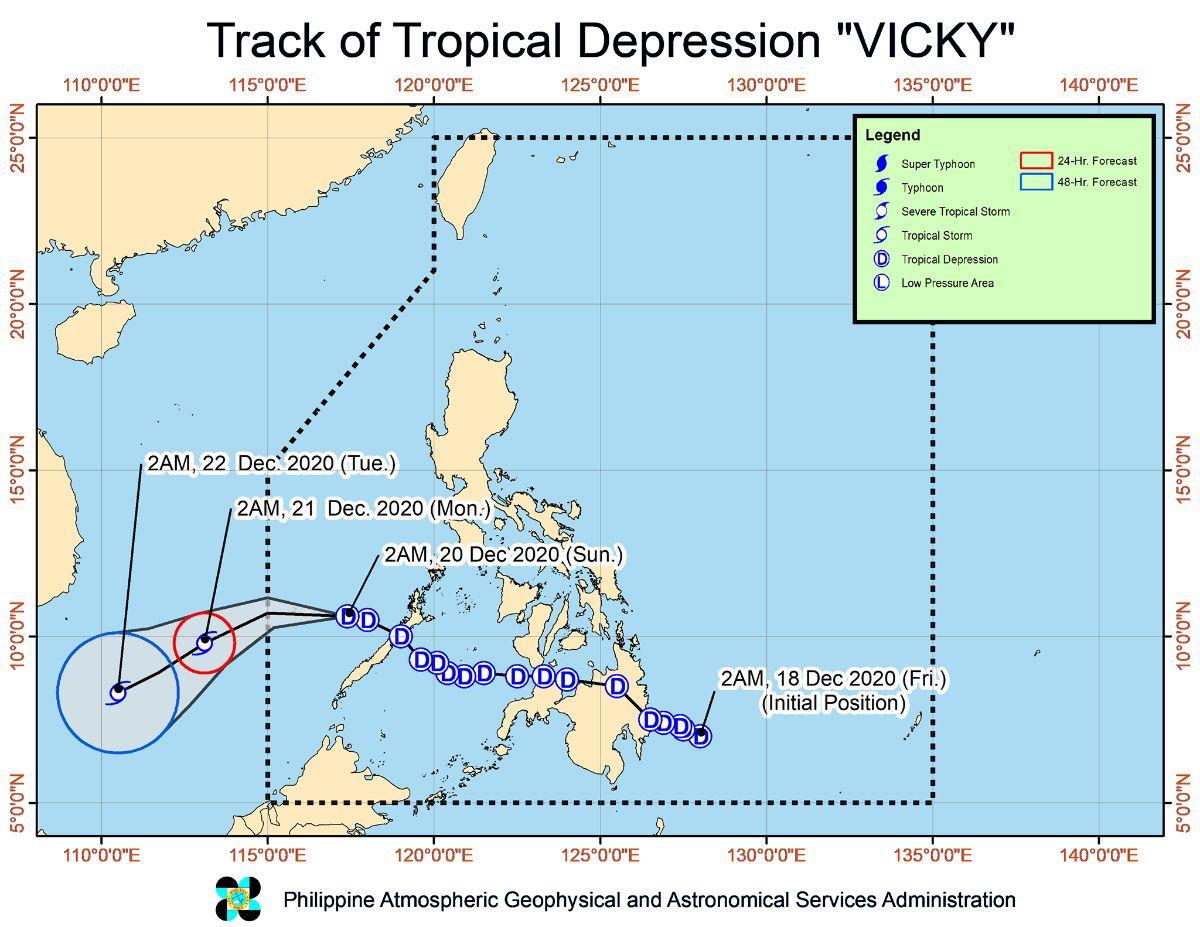
Tropical Cyclone Wind Signal No. 1 is still raised over Kalayaan Islands in Palawan as Tropical Depression Vicky moves closer to the western limits of the Philippine Area of Responsibility on Sunday afternoon.
In its 11 a.m. severe weather bulletin, state weather bureau PAGASA said Vicky is expected to move westward or southwestward over the West Philippine Sea in the next 12 hours.
At 10 a.m., Vicky was located at 135 kilometers east-southeast of Kalayaan, Palawan with maximum sustained winds 55 km per hour and gustiness of up to 70 kph, moving westwards at 35 kph.
Due to the tropical depression, Kalayaan Islands will be experiencing strong breeze to near gale conditions.
Most parts of Luzon will experience gusty conditions especially in coastal and mountainous areas, due to the surge of the Northeast Monsoon.
Moderate to heavy with at times intense rains are expected over mainland Cagayan Valley, Apayao, Kalinga, Mountain Province, Ifugao, Aurora, Quezon, Bicol Region, and northern portion of Palawan including Calamian Islands, and Kalayaan Islands.
Light to moderate with at times heavy rains will be experienced Babuyan Islands, Metro Manila, Northern Samar, and the rest of Cordillera Administrative Region, Central Luzon, Calabarzon, and Mimaropa.
These weather conditions are due to the combined effects of Vicky, the tail-end of a Frontal System (Shear Line), and low pressure area, PAGASA said.
On Monday, moderate to heavy rains are expected over Babuyan Islands, mainland Cagayan Valley, Aurora, Apayao, Kalinga, Mountain Province, Ifugao, and the northern portion of Quezon.
Light to moderate with at times heavy rains will be experienced over Batanes, Kalayaan Islands, and the rest of Cordillera Administrative Region.
PAGASA warned of possible flooding including flashfloods, and rain-induced landslides during heavy or prolonged periods of rainfall, especially in areas prone to these hazards and that received significant antecedent rainfall over the past couple of days or weeks.
The state weather bureau also warned adjacent or nearby areas of flooding due to surface runoff or swelling of river channels.
In the next 24 hours, rough to high seas of up to 6 meters are expected over the entire seaboards of Northern Luzon due to the combined effects of the surge of the Northeast Monsoon and Vicky.
Rough to very rough seas of up to 5 meters will be experienced over the seaboard of Zambales, the western seaboard of Bataan, the seaboard of Lubang Island, the western seaboard of Palawan including Calamian and Kalayaan Islands, the seaboard of Aurora, the eastern seaboard of Quezon including Polillo Islands.
The same sea conditions are expected over the seaboard of Camarines Norte, the northern seaboard of Camarines Norte, the northern and eastern seaboards of Catanduanes, the eastern seaboard of Albay including Rapu-Rapu Islands, the eastern seaboard of Sorsogon, and the northern and eastern seaboards of Northern Samar.
“Sea travel remains risky over these waters, especially for small sea crafts,” PAGASA warned.
Moderate to rough seas of up to 3.5 meters are also expected over the western seaboard of Batangas, the western seaboard of Occidental Mindoro, eastern seaboard of Eastern Samar including Homonhon Island, the eastern seaboard of Dinagat Islands, the eastern seaboard of Surigao del Norte including Siargao and Bucas Grande Islands, and the eastern seaboard of Surigao del Sur.
“Mariners of small sea crafts are advised to take precautionary measures when venturing out to sea. Inexperienced mariners should avoid navigating in these conditions,” PAGASA said.
After exiting the PAR on Sunday, PAGASA said Vicky will turn towards the southwest as it comes under the full influence of the surge of the Northeast Monsoon.
Vicky is expected to intensity into a tropical storm in the next 24 hours, but it is less likely to reach severe tropical storm category throughout the forecast period due to marginally favorable conditions, PAGASA said.
Aside from Vicky, PAGASA is also monitoring the low pressure area located at 140 km East of Virac, Catanduanes, which is less likely to develop into a tropical depression in the next 24 hours. —LBG, GMA News
