
Signal No. 1 raised over 8 areas as typhoon Bising rapidly intensifies
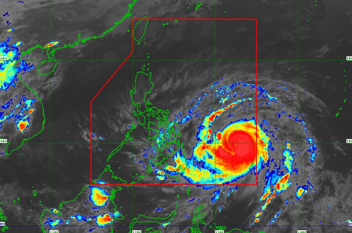
Tropical Cyclone Wind Signal (TCWS) No. 1 was raised over eight areas as typhoon Bising rapidly intensified over the Philippine Sea east of Northern Mindanao, PAGASA announced late Friday evening.
In its 11 p.m. severe weather bulletin, PAGASA said the following areas are under TCWS No. 1:
- Eastern Samar
- The eastern portion of Northern Samar (Las Navas, Catubig, Laoang, Palapag, Mapanas, Gamay, Lapinig)
- The central and southern portions of Samar (Marabut, Basey, Santa Rita, Villareal, Talalora, Daram, Pinabacdao, Zumarraga, Calbiga, San Sebastian, Hinabangan, Paranas, Motiong, Jiabong, Catbalogan City, Tarangnan, San Jorge, Pagsanghan, Gandara, Matuguinao, San Jose de Buan)
- The eastern portion of Leyte (Abuyog, Mahaplag, Javier, Macarthur, Mayorga, La Paz, Dulag, Julita, Burauen, Tolosa, Tanauan, Tabontabon, Dagami, Pastrana, Palo, Jaro, Alangalang, Santa Fe, Tacloban City, Babatngon, San Miguel, Barugo, Tunga)
- The eastern portion of Southern Leyte (Sogod, Silago, Hinunangan, Hinundayan, Anahawan, San Juan, Saint Bernard, Libagon, Liloan, San Ricardo, Pintuyan, San Francisco)
- Dinagat Islands
- Surigao del Norte (including Siargao and Bucas Grande Islands)
- Surigao del Sur
PAGASA said TCWS No. 1 may also be raised over the rest of Eastern Visayas and portions of the Bicol Region.
At 10 p.m., the center of Bising was estimated 790 kilometers east of Surigao City, Surigao del Norte with maximum sustained winds of 150 kilometers per hour near the center and gustiness of up to 185 kph.
It is moving west-northwestward at 15 kph.
According to the weather agency, Bising will move generally west-northwestward or northwestward over the Philippine Sea until Monday before it will slow down and move northward on Tuesday.
It is forecast to reach peak intensity by Sunday.
PAGASA said the highest level of wind signal that may be issued is TCWS No. 2
“However, in the event of a further westward shift in the track forecast, there is a possibility that some localities will be placed under higher levels of wind signal,” it said.
Hazards affecting land and coastal waters
From Saturday evening to Sunday night, Bisong is expected to bring moderate to heavy rains with, at times, intense rains over Eastern Visayas and Camotes Islands.
The weather agency warned against possible flooding, including flash floods, and rain-induced landslides in the affected areas.
Meanwhile, a strong breeze to near gale in strength may also extend outward up to 500 kilometers from the center of the Bising.
According to PAGASA, Bising will also bring rough to very rough seas over the eastern seaboards of the Bicol Region, Eastern Visayas, Caraga, and the Davao Region in the next 24 hours.
It warned that sea travel for all types of seacrafts is risky.
The next severe weather bulletin will be released at 5 a.m. on Saturday.—LDF, GMA News
