
Areas under Signal No. 1 now at 15 as Bising slightly intensifies
Areas under Tropical Cyclone Wind Signal No. 1 rose to over 15 on Saturday morning as Typhoon Bising slightly intensified while moving northwestwards over the Philippine Sea, PAGASA said in its 11 a.m. bulletin.
In the advisory, PAGASA said TCWS No. 1 is raised over the following areas:
Luzon
- Sorsogon
- Albay
- the eastern portion of Camarines Sur (Siruma, Goa, Ocampo, Tigaon, Sagnay, Baao, Nabua, Bato, Iriga City, Buhi, Tinambac, Lagonoy, San Jose, Garchitorena, Presentacion, Caramoan)
- Ticao Island
- Catanduanes
Visayas
- Northern Samar
- Samar
- Eastern Samar
- Biliran
- Leyte
- Southern Leyte
- Camotes Islands
Mindanao
- Dinagat Islands
- Surigao del Norte (including Siargao and Bucas Grande Islands)
- Surigao del Sur
On Sunday, the cloud bands of Typhoon Bising will bring moderate to heavy with at times intense rains over Eastern Visayas, Sorsogon, Masbate, Albay, Camarines Sur, Catanduanes, and Camotes Islands.
On Monday, moderate to heavy with at times intense rains are expected over Northern Samar and Bicol Region.
Under the said conditions, flooding, including flash floods, and rain-induced landslides may occur especially in areas identified in hazard maps as highly or very highly susceptible to the hazards.
As Typhoon Bising further intensifies, tropical cyclone winds of at least strong breeze to near gale in strength are expected to extend outward up to 550 km from the typhoon's center, while destructive typhoon-force winds will extend outward up to 70 km from the center.
In anticipation of the onset of strong breeze to near gale conditions associated with the approaching typhoon, PAGASA said TCWS #1 may be hoisted over the eastern portion of Masbate and the other localities of Camarines Sur in the next bulletin.
TCWS #2 remains the highest level of wind signal that will be hoisted due to Bising based on the current forecast scenario, PAGASA added.
Hazards in coastal waters
Rough to very rough seas due to Typhoon Bising will be experienced over the eastern seaboards of Bicol Region (2.5 to 4.5 m), Eastern Visayas (2.5 to 6.5 m), Caraga (2.5 to 5.5 m) and Davao Region (2.5 to 3.0 m). Sea travel for all types of sea crafts is thus risky over these waters.
Bising's track and intensity outlook
The state weather bureau said Typhoon Bising will move generally northwestward over the Philippine Sea until Sunday afternoon or evening. The typhoon will then slow down and move northward or north-northeastward until Tuesday early morning before moving generally north-northwestward over the Philippine Sea east of Northern and Central Luzon.
Considering uncertainty in typhoon Bising's track forecast, a westward shift in the current forecast track may result in potentially significant impacts over the eastern portions of Luzon and Visayas. The possibility of a landfall scenario is not ruled out, PAGASA said.
Bising is forecast to further intensify and reach its peak intensity (195 to 205 km/h) on Sunday.
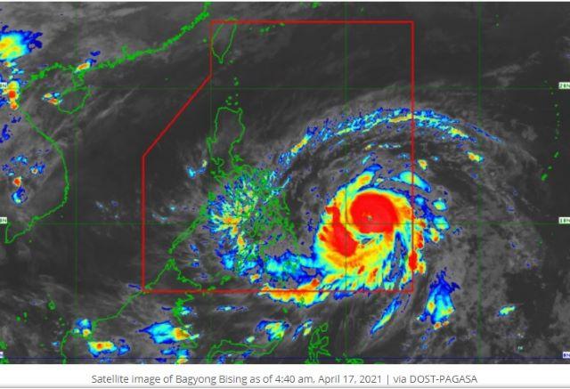
As of 10 a.m., the center of the eye of Typhoon Bising was located based on all available data at 645 km east of Maasin City, Southern leyte or 545 km east of Guiuan, Eastern Samar.
It is moving northwestwards at 20 km/h with maximum sustained winds of 185 km/h near the center and gustiness of up to 230 km/h. —LBG, GMA News
