
Rain expected over east Philippine areas as Bising accelerates, intensifies
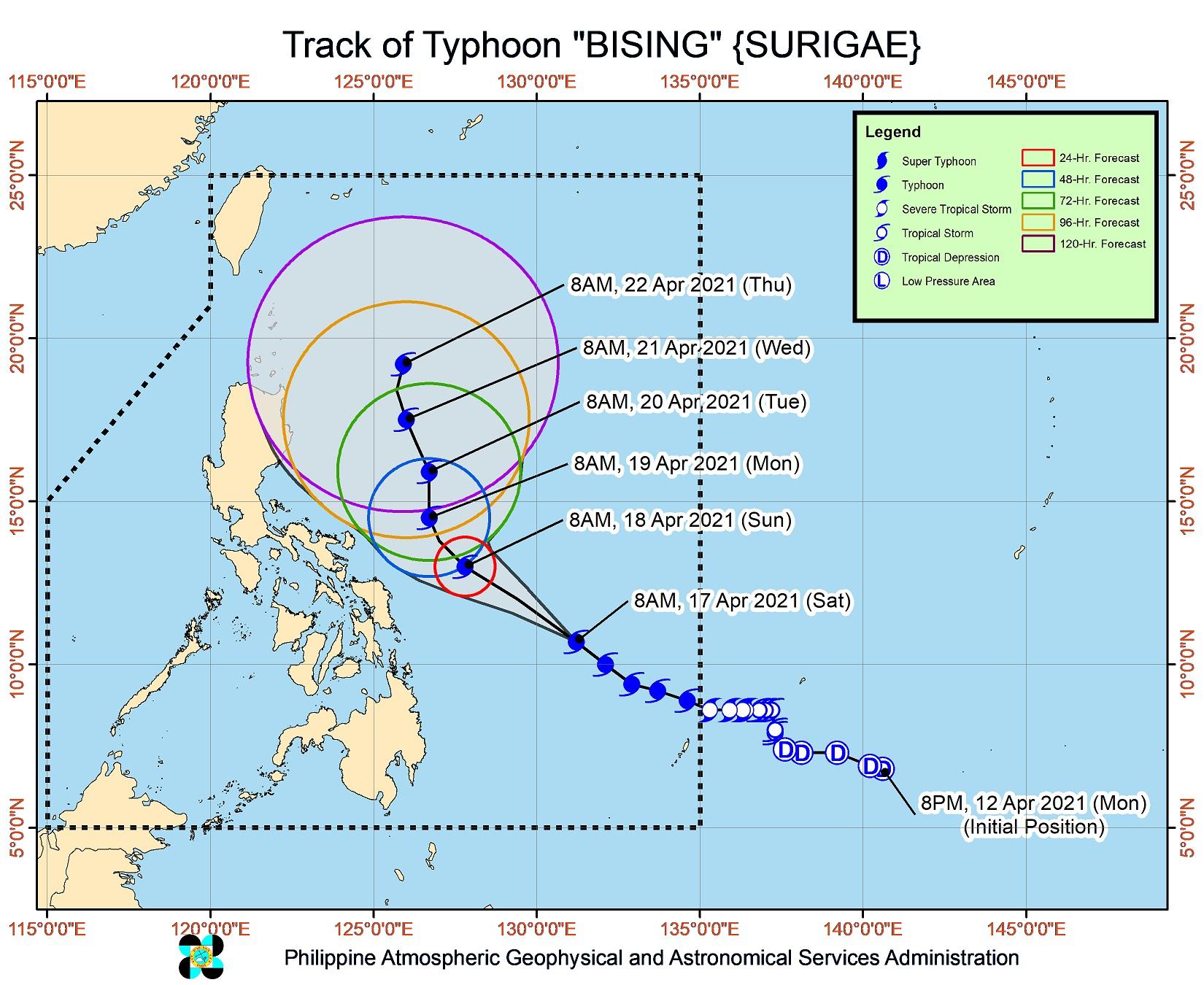
Tropical Cyclone Wind Signal (TCWS) No. 2 was raised over Catanduanes, Northern Samar, Eastern Samar, and Samar as Typhoon Bising {international name Surigae} slightly accelerated and intensified over the Philippine Sea, PAGASA said Saturday afternoon.
In its 5 p.m. severe weather bulletin, the weather agency said the following areas remained under TCWS No. 1:
Meanwhile, the following areas remained under TCWS No. 1:
Luzon
- Sorsogon
- Albay
- The eastern portion of Camarines Sur (Calabanga, Naga City, Pili, Bula, Bombon, Magarao, Canaman, Gainza, Camaligan, Milaor, Minalabac, Tinambac, Siruma, Lagonoy, Goa, Tigaon, Ocampo, Baao, Iriga City, Nabua, Balatan, Bato, Buhi, Sagnay, San Jose, Garchitorena, Presentacion, Caramoan, San Fernando)
- The eastern portion of Masbate (Baleno, Masbate City, Mobo, Uson, Dimasalang, Palanas, Cataingan, Pio V. Corpuz) including Ticao Island
Visayas
- Biliran
- Leyte
- Southern Leyte
- Camotes Islands
Mindanao
- Dinagat Islands
- Surigao del Norte (including Siargao and Bucas Grande Islands)
- Surigao del Sur
At 4 p.m. on Saturday, the center of Bising was 460 kilometers east of Guiuan, Eastern Samar with maximum sustained winds of 195 kilometers per hour near the center and gustiness of up to 240 kph.
It was moving west-northwestward at 25 kph.
PAGASA said Bising will move northwestward over the Philippine Sea until Sunday afternoon. It will then slow down and move generally northward until Tuesday.
Bising is expected to further intensify and reach peak intensity on Sunday.
The next severe weather bulletin is set to be issued at 5 a.m. on Sunday.
Hazards affecting land
On Sunday, the rainbands of Bising are expected to bring moderate to heavy with, at times, intense rains over the Eastern Visayas, the Bicol Region, and the southern portion of Quezon.
Meanwhile, moderate to heavy with, at times, intense rains are expected to prevail over Northern Samar, Bicol Region, and the southern portion of Quezon on Monday.
“Under these conditions, flooding (including flashfloods) and rain-induced landslides may occur,” PAGASA warned.
According to the weather agency, winds ranging from a strong breeze to near gale force in strength may also extend up to 400 kilometers from the center of Bising while gale-force winds may extend up to 300 kilometers.
Meanwhile, destructive typhoon-force winds extend outward up to 90 kilometers from the center of the typhoon.
Hazards affecting coastal waters
According to PAGASA, rough to high seas will prevail over the eastern seaboards of Luzon and areas under TCWS in the next 24 hours.
Rough to very rough seas were meanwhile expected over the remaining seaboards of Northern Luzon and the eastern seaboards of Mindanao.
PAGASA said sea travel was risky for all types of seacraft. — DVM, GMA News
