
Bising to bring moderate to heavy rain over the Bicol, East Visayas Regions
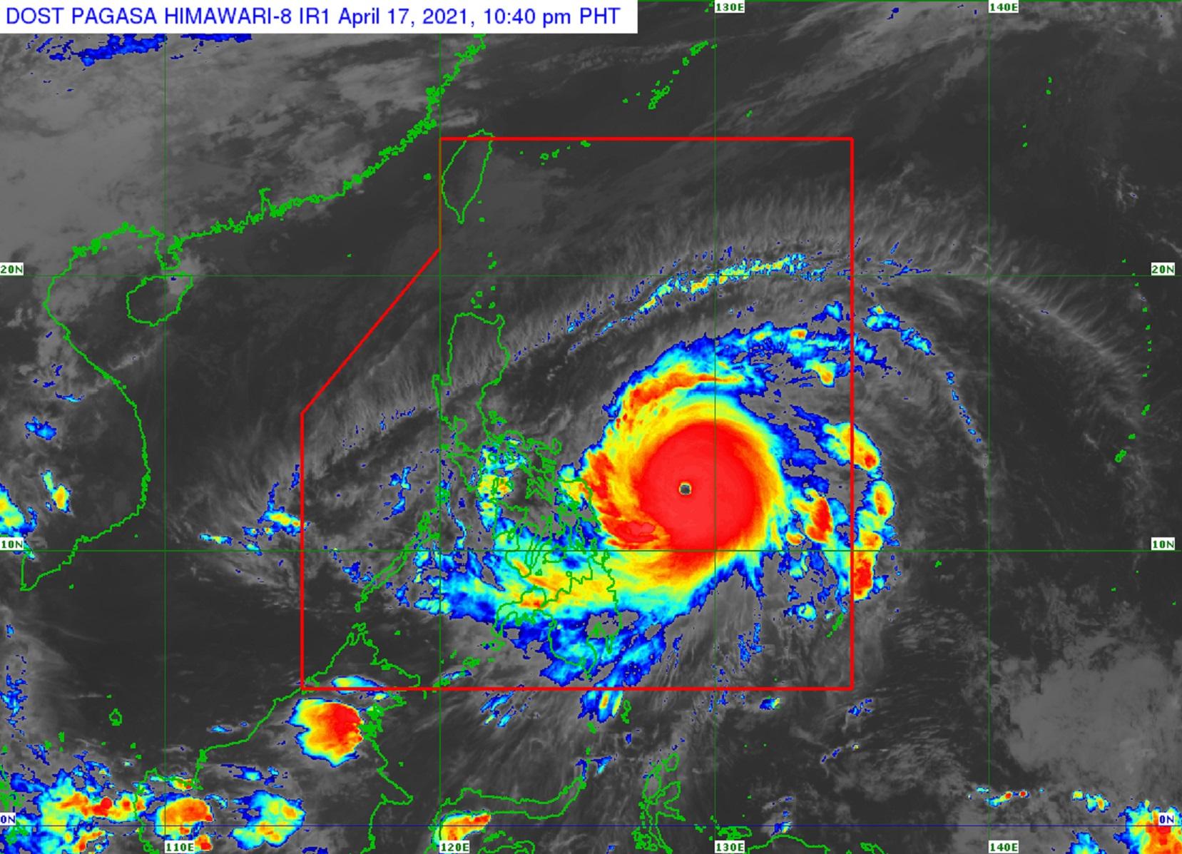
Typhoon Bising {international name Surigae} was intensifying rapidly while moving northwestward over the Philippine Sea east of Samar Island, PAGASA said Saturday.
In its 11 p.m. severe weather bulletin, the weather agency said that Tropical Cyclone Wind Signal (TCWS) No. 2 remained raised over:
- Catanduanes
- Northern Samar
- Eastern Samar
- Samar
Meanwhile, the following areas were under TCWS No. 1:
- The eastern portion of Camarines Norte (San Lorenzo Ruiz, San Vicente, Vinzons, Talisay, Daet, Mercedes, Basud)
- Camarines Sur
- Albay
- Sorsogon
- Masbate including Burias and Ticao Islands
- Biliran
- Leyte
- Southern Leyte
- The northern portion of Cebu (Tabogon, Borbon, San Remigio, Bogo City, Medellin, Daanbantayan) including Bantayan and Camotes Islands
- Dinagat Islands
- Surigao del Norte including Siargao and Bucas Grande Islands
- Surigao del Sur
PAGASA said that based on the current scenario, the highest level of wind signal that may be raised was TCWS No. 2.
At 10 p.m. on Saturday, Bising was 395 kilometers east of Borongan City, Eastern Samar with maximum sustained winds of 215 kilometers per hour near the center and gustiness of up to 265 kph.
The typhoon was moving northwestward at 20 kph.
Bising was expected to be closest to the Bicol Region or the Samar Provinces between Sunday morning and Monday morning.
“The possibility of a landfall or close approach scenario is not ruled out,” PAGASA emphasized.
Though Bising was likely to maintain its strength in the next 24 hours, PAGASA said it could also intensify into a super typhoon during the same period.
Hazards affecting land
On Sunday, Bising would bring moderate to heavy, with at times intense rain over the Eastern Visayas and the Bicol Region.
It would also bring moderate to intense rain over the Bicol Region, Northern Samar, Samar, and Eastern Samar on Monday.
PAGASA warned against possible flash floods or landslides.
Winds of at least a strong breeze to near gale force in strength may also extend outward up to 440 kilometers from the center of Bising while destructive typhoon-force winds would extend outward up to 110 kilometers from the center of the typhoon.
Hazards affecting coastal waters
Meanwhile, very rough to very high seas are expected over the northern and eastern seaboard of Eastern Visayas.
Rough to very high seas may also prevail over the eastern seaboard of Luzon while rough to very rough seas are expected over the eastern seaboard of Caraga.
“Sea travel is risky for all types of seacrafts over these waters,” PAGASA said.
Rough to very rough seas were also expected over the northern and western seaboards of Northern Luzon and the eastern seaboard of the Davao Region.
PAGASA warned that sea travel was risky for small seacraft.
Meanwhile, moderate to rough seas may prevail over the seaboards of areas under wind signals.
“Mariners of small seacraft are advised not to venture out over these waters,” PAGASA said. — DVM, GMA News
