

Moderate to rough seas in north Luzon as Bising weakens further
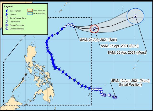
Moderate to rough seas are expected over the northern and eastern seaboards of Northern Luzon in the next 24 hours as Severe Tropical Storm Bising continues to weaken while moving east-southeastward over the Philippine Sea, PAGASA said in its 11 a.m. update. on Friday.
In its advisory, PAGASA said moderate to rough seas of 1.5 to 3.5 meters will be experienced in the said seaboards.
Mariners of small sea crafts are advised not to venture out over the waters, while inexperienced mariners should avoid navigating in these conditions.
Bising is forecast to exit the Philippine Area of Responsibility on Sunday morning, the state weather bureau said. Further weakening is expected throughout the forecast period following unfavorable atmospheric and oceanic conditions.
Bising is forecast to completely transition into an extratropical cyclone outside the Philippine Area of Responsibility on Monday.
As of 10 a.m. on Saturday, the center of Severe Tropical Storm Bising was estimated based on all available data at 1,005 km east northeast of Extreme Northern Luzon.
It is moving east southeastward at 15 km/h with maximum sustained winds of 95 km/h near the center and gustiness of up to 115 km/h.
No Tropical Cyclone Wind Signal was issued. —Jamil Santos/LBG, GMA News
