

Crising continues westward movement, now over Davao del Norte
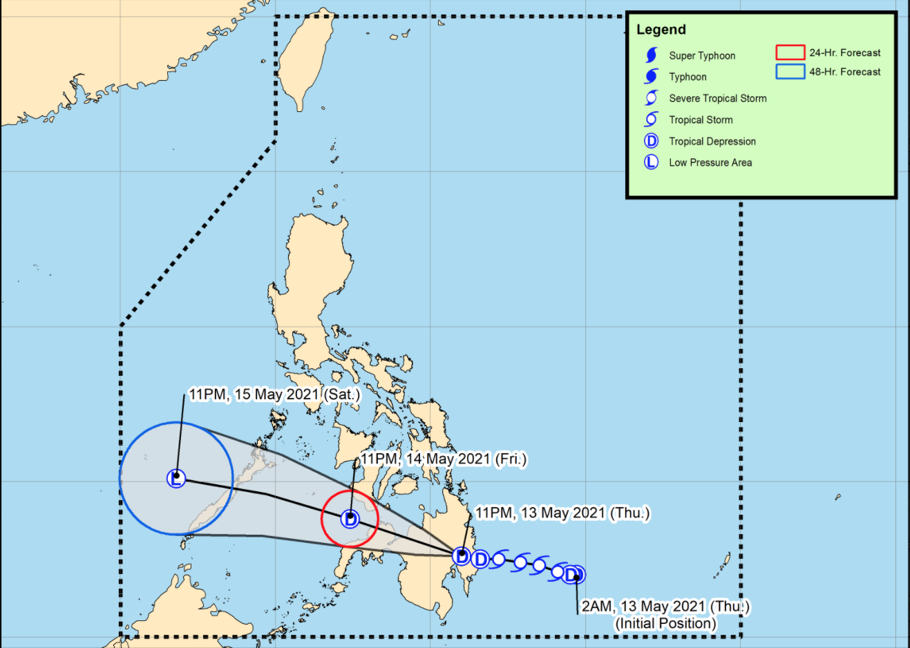
Tropical Depression Crising continues to move generally westward and is now over Davao del Norte, according to the 2 am Severe Weather Bulletin posted by PAGASA.
Light to moderate with at times heavy rains may be experienced over Davao Oriental, Davao de Oro, Davao del Norte, Davao City, Cotabato, Maguindanao, Bukidnon, Lanao del Norte, Lanao del Sur, Misamis Occidental, Zamboanga del Sur, and the northern portion of Zamboanga del Norte.
As of 1 am on Friday, the center of Tropical Depression Crising was estimated in the vicinity of New Corella, Davao del Norte with maximum sustained winds of 55 kilometers per hour near the center and gustiness of up to 90 kph moving westward at 20 kph.
Tropical Cyclone Wind Signal (TCWS) No. 1 is raised over the following areas:
Visayas
- the southeastern portion of Negros Oriental (Dumaguete City, Valencia, Sibulan, Santa Catalina, Siaton, Zamboanguita, Dauin, Bacong)
- Siquijor
Mindanao
- the southern portion of Surigao del Sur (Barobo, Tagbina, Hinatuan, City of Bislig, Lingig)
- the central and southern portions of Agusan del Sur (Esperanza, San Francisco, Talacogon, San Luis, Rosario, Bunawan, Trento, La Paz, Loreto, Veruela, Santa Josefa)
- Davao Oriental
- Davao de Oro
- Davao del Norte
- Davao City
- the northern portion of Cotabato (Magpet, Arakan, Antipas, President Roxas, Matalam, City of Kidapawan, Kabacan, Carmen, Banisilan, Alamada)
- the northern portion of Maguindanao (Buldon, Barira, Matanog)
- Lanao del Norte
- Lanao del Sur
- Misamis Occidental
- Bukidnon
- the central and western portions of Misamis Oriental (Claveria, Balingasag, Lagonglong, Jasaan, Villanueva, Tagoloan, Cagayan de Oro City, Opol, City of El Salvador, Alubijid, Laguindingan, Gitagum, Libertad, Initao, Naawan, Manticao, Lugait)
- the northeastern portion of Zamboanga del Sur (Midsalip, Sominot, Dumingag, Molave, Mahayag, Josefina, Tambulig, Ramon Magsaysay, Aurora, Tukuran, Labangan)
- the northeastern portion of Zamboanga del Norte (Sergio Osmeña Sr., Katipunan, Pres. Manuel A. Roxas, Jose Dalman, Manukan, Dipolog City, Polanco, Piñan, Mutia, Dapitan City, Sibutad, Rizal, La Libertad)
There may be isolated to scattered flooding (including flash floods) and rain-induced landslides are possible during heavy or prolonged rainfall especially in areas that are highly or very highly susceptible to these hazards as identified in hazard maps.
Strong breeze to near gale conditions is likely over the localities where Tropical Cyclone Wind Signal No. 1 is in effect, especially in the coastal and mountainous areas of these localities.
In the next 24 hours, there may be moderate to rough seas will be experienced over the seaboards of areas under TCWS No. 1 so mariners of small seacrafts are advised not to venture out over these waters.
Crising will be moving westward or west northwestward and cross the rugged terrain of Mindanao before emerging over the Sulu Sea tonight and cross Palawan tomorrow. -- BAP, GMA News
