
Fabian intensifies into typhoon; Signal no. 1 may be raised over Batanes, Babuyan
Severe tropical storm Fabian has intensified into a typhoon, according to PAGASA on Tuesday afternoon.
In its 5 p.m. severe weather bulletin, the state weather agency said that Tropical Cyclone Wind Signal (TWCS) No. 1 may be raised over Batanes and the Babuyan Islands. Residents are advised to continuously monitor tropical cyclone bulletins.
Despite this, PAGASA said Fabian is unlikely to bring heavy rainfall over the country throughout the forecast period.
Fabian is also enhancing the southwest monsoon.
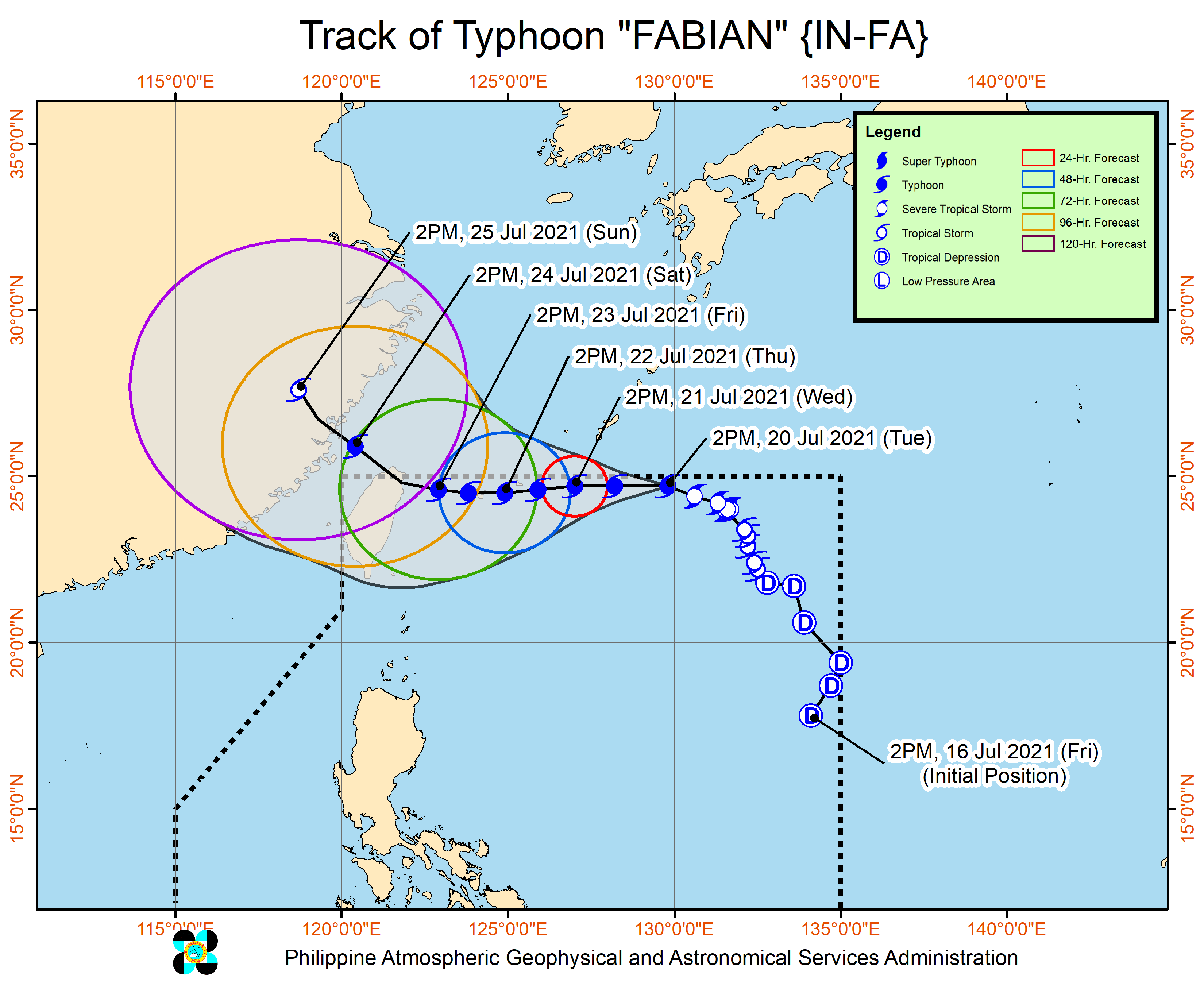
As of 4 p.m., the center of the eye of the typhoon was estimated at 895 kilometers east-northeast of extreme Northern Luzon with maximum sustained winds of 120 kilometers per hour near the center and gustiness of up to 150 kph.
It is moving west-northwestward at 15 kph.
PAGASA said Fabian is forecast to make landfall in the vicinity of Yaeyama, Miyako, and Senkaku Islands in the Ryukyu Archipelago, Japan on Thursday.
It may then exit the Philippine Area of Responsibility on Friday evening or early Saturday morning.
The next severe weather bulletin will be issued at 11 p.m. on Tuesday.
Hazards affecting land and coastal waters
According to the weather agency, monsoon rains may prevail over Metro Manila, Ilocos Region, Cordillera Administrative Region, Zambales, Bataan, Pampanga, Cavite, Batangas, Occidental Mindoro, northern Palawan, including Calamian and Cuyo Islands, Batanes, and the Babuyan Islands in the next 24 hours.
Meanwhile, rough to very rough seas may prevail over the seabords of Batanes, the northern seaboard of Cagayan, the western seaboard of Palawan, and Oriental Mindoro.
“Sea travel is risky for small seacrafts over these waters. Mariners without the proper experience should immediately seek safe harbor,” PAGASA said.—AOL, GMA News
