

Jolina out of PAR; Signal No. 2 up over Cagayan, Babuyan islands due to Kiko
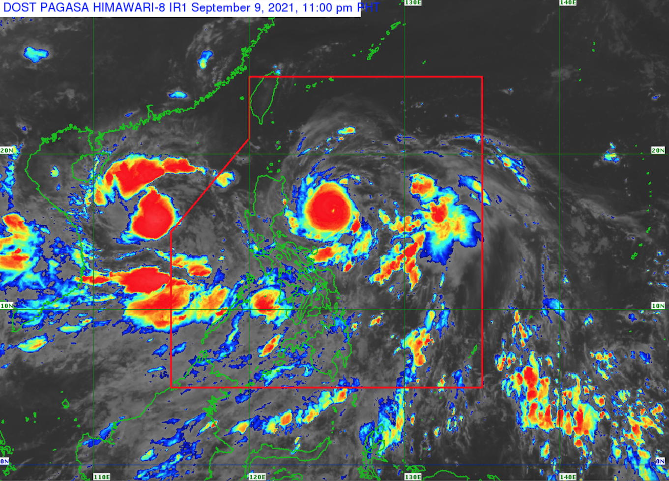
Severe Tropical Storm Jolina is now out of the Philippine Area of Responsibility (PAR) while Tropical Cyclone Wind Signal No. 2 was raised in Cagayan and the Babuyan Islands as Typhoon Kiko maintained its strength and moved west northwestward over the Philippine Sea east of northern Aurora towards extreme Northern Luzon, PAGASA said Thursday night.
In its 11 p.m. severe weather bulletin, PAGASA said the eye of Kiko was located 435 kilometers east of Baler, Aurora or 370 km east of Casiguran, Aurora at 4 p.m. with maximum sustained winds of 195 km per hour near the center, gustiness of up to 240 kph, and central pressure of 930 hPa.
TCWS No. 2 was hoisted over:
- the northeastern portion of mainland Cagayan (Santa Ana, Gonzaga, Santa Teresita, Lal-Lo, Buguey, Gattaran, Baggao)
- the eastern portion of Babuyan Islands (Camiguin Island, Didicas Island, Pamuktan Island, and Babuyan Island)
TCWS No. 1 was raised in the following:
- Batanes
- the rest of mainland Cagayan
- the rest of Babuyan Islands
- the northeastern portion of Apayao (Luna, Pudtol, Flora, Santa Marcela)
- the eastern portion of Isabela (Divilacan, Palanan, Maconacon, San Pablo, Santa Maria, Tumauini, Cabagan, San Mariano, Ilagan City, Dinapigue)
From Friday afternoon to Sunday evening, PAGASA said heavy to intense with, at times, torrential rains will be experienced over Cagayan including Babuyan Islands, Batanes, and northern Isabela, while moderate to heavy with, at times, intense rains will prevail over the rest of Isabela, the northern portion of Aurora, Ilocos Norte, and Apayao.
"Under these conditions, scattered to widespread flooding (including flash floods) and rain-induced landslides are possible especially in areas that are highly or very highly susceptible to these hazard as identified in hazard maps," PAGASA said.
PAGASA also said winds reaching gale to storm force in strength will be experienced in areas under TCWS No. 2 during the passage of the typhoon, which may result in light to moderate damage to structures and vegetation.
Winds reaching strong breeze to near gale in strength with occasional gusts will also be experienced in areas under TCWS No. 1, which may result in very light damage to structures and vegetation.
A moderate risk of storm surge reaching 1.0 to 2.0 meters in height may also occur in the next 48 hours and rising sea water along with the high waves from the shore line moving inland may cause flooding in the low-lying coastal localities of Batanes, Cagayan including Babuyan Islands, and Isabela, PAGASA said.
In the next 24 hours, rough to high seas (2.5 to 6.0 m) will be experienced over the seaboards of areas under any TCWS, while moderate to rough seas (1.2 to 3.0 m) will prevail over the eastern seaboards of Central and Southern Luzon.
"Sea travel is risky for those using small seacrafts. Mariners are advised to take precautionary measures when venturing out to sea and, if possible, avoid navigating in these conditions," PAGASA said.
PAGASA said Kiko is forecasted to pass very close to northeastern Cagayan on Friday afternoon or evening. Afterwards, the typhoon may cross the vicinity of Babuyan Islands and Batanes or pass within their coastal waters from Friday evening until Saturday afternoon.
Jolina out of PAR
PAGASA said Severe Tropical Storm Jolina is now outside the Philippine Area of Responsibility and re-intensified into a severe tropical storm over the West Philippine Sea.
The center of Jolina was located 605 km west of Dagupan City, Pangasinan at 10 p.m. with maximum sustained winds of 95 kph near the center, gustiness of up to 115 kph, and central pressure of 990 hPa. It is moving westward at 30 kph.
PAGASA said Jolina and Kiko will continue to enhance the southwest monsoon, bringing rains over the western sections of Southern Luzon and Visayas in the next 24 hours.
The enhanced southwest monsoon will bring strong winds (strong breeze to near gale conditions) with occasional gusts over Palawan, Romblon and the coastal and upland/mountain areas of Visayas, Bicol Region, and Occidental Mindoro.
In the next 24 hours, Jolina and the enhanced southwest monsoon will bring rough to very rough seas (2.8 to 4.5 m) over the western seaboards of Palawan including Calamian and Kalayaan Islands, while moderate to rough seas (1.2 to 3.1 m) will prevail over the remaining western seaboards of Luzon. -- BAP, GMA News
