

Odette maintains strength, Signal No. 3 over Kalayaan Islands on its way outside PAR
Typhoon Odette maintains its strength and is now threatening the Kalayaan islands, according to the 5 a.m. Tropical Cyclone Bulletin posted by PAGASA.
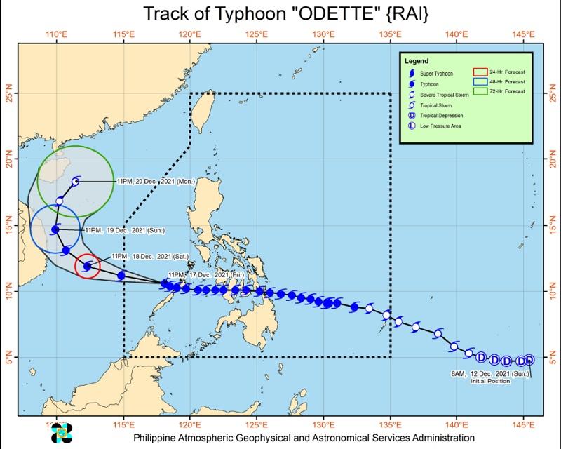
As of 4 a.m., the center of the eye of Typhoon Odette was located at 240 kilometers west northwest of Puerto Princesa City, Palawan packing maximum sustained winds of 150 kilometers per hour near the center, gustiness of up to 185 kph, central pressure of 960 hPa, and moving in the west northwest direction at a speed of 15 kph.
Tropical Cyclone Wind Signal (TCWS) No. 3 is hoisted over the Kalayaan Islands, the weather bureau reported.
TCWS No. 2, meanwhile, is raised over the central portion of Palawan (San Vicente, Quezon, Puerto Princesa City, Aborlan)
The rest of mainland Palawan (Balabac, Rizal, Bataraza, Brooke's Point, Sofronio Española, Narra, Roxas, Taytay, Dumaran, Araceli, El Nido) including Calamian has been placed under TCWS No. 1.
Tropical Cyclone Wind Signals hoisted in areas that are no longer listed herein are hereby lifted.
HEAVY RAINFALL
On Saturday, Kalayaan Islands will experience heavy to torrential rains while Palawan, Aurora, and the northern portion of Quezon including Polillo Islands will experience moderate to heavy rains.
Meanwhile, light to moderate with at times heavy rains over Bicol Region, Northern Samar, Nueva Vizcaya, Quirino, Nueva Ecija, and the rest of Quezon.
Scattered to widespread flooding (including flash floods) and rain-induced landslides may be expected in highly susceptible areas.
SEVERE WINDS
Destructive typhoon-force winds will be experienced within areas under TCWS No. 3 causing moderate to heavy damage to structures and vegetation.
Within the area under TCWS No. 2, residents may experience damaging winds reaching gale- to storm-force strength that may result in generally light to moderate damage to structures and vegetation.
Strong winds, meanwhile, are expected within areas under TCWS No. 1 that may generally bring up to very light damage to structures and vegetation.
COASTAL INUNDATION
There is still a moderate to high risk of storm surge which may result in life-threatening coastal flooding in Kalayaan Islands. At the coastal areas under TCWS No. 2 and No. 1 may also experience coastal flooding.
A Gale Warning remains as Typhoon Odette continues to be influenced by the prevailing northeast monsoon.
Mariners are advised to take precautionary measures when venturing out to sea and, if possible, avoid navigating in these conditions.
TRACK AND INTENSITY OUTLOOK
Odette, while over the West Philippine sea, is forecast to move in the west northwest direction and may exit the Philippine Area of Responsibility (PAR) by Saturday morning or afternoon. -- BAP, GMA News
