
Storm outside PAR may enhance Habagat to bring monsoon rains over Southern Luzon, Visayas
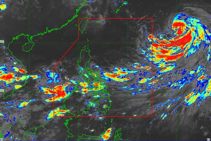
Tropical Storm Nanmadol, which is still outside the Philippine Area of Responsibility (PAR), has slightly intensified while moving slowly northwestward, PAGASA said on Wednesday evening.
In its 11 p.m. Tropical Cyclone Advisory, PAGASA said Nanmadol is forecast to continue turning northwestward then gradually accelerate as it moves westward or west northwestward on Thursday and turn more northwestward on Friday and Saturday.
Nanmadol may enter PAR on Thursday evening or Friday morning, which will by then be given the domestic name “Josie.”
“Improving environmental conditions by tomorrow will enable the tropical cyclone to further intensify. Current forecast scenario shows that this tropical cyclone will reach severe tropical storm category within 12 hours and enter the PAR as a typhoon,” PAGASA said.
Habagat
While Nanmadol is not expected to directly affect the weather conditions in the country, PAGASA said it may enhance the southwest monsoon or Habagat within the forecast period.
“This may bring monsoon rains over Southern Luzon and Visayas, especially on their western sections, beginning tonight or tomorrow. As such, the issuance of a Weather Advisory is not ruled out should heavy rains become possible or likely,” it added.
As of 10 p.m., the center of Nanmadol was located 1,910 km east of Extreme Northern Luzon packing maximum sustained winds of 85 km/h near the center, gustiness of up to 105 km/h, and central pressure of 998 hPa while moving slowly in the east northeast direction.
The storm may bring strong to gale-force winds that extended outwards up to 380 km from the center. -- BAP, GMA News
