
Neneng maintains strength, brings heavy rains over North Luzon
Tropical Depression Neneng continues to maintain its strength while moving in the west northwest direction, according to the Tropical Cyclone update posted by PAGASA early Friday morning.
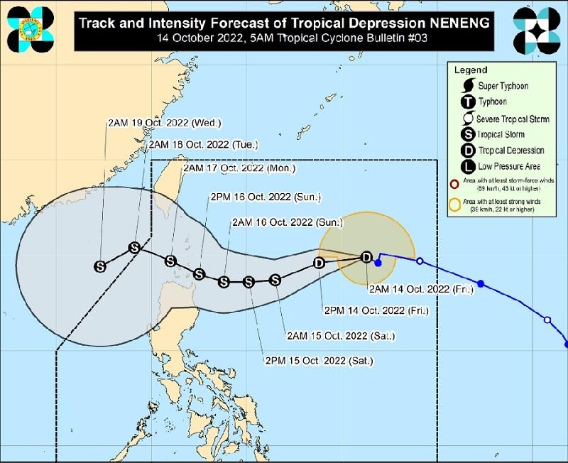
The center of Tropical Depression Neneng was estimated at 1,015 kilometers east of extreme Northern Luzon packing maximum sustained winds of 55 kilometers per hour near the center, gustiness of up to 70 km/h, central pressure of 1000 hPa, and moving west northwestward at 10 km/h.
There are no Tropical Cyclone Wind Signal is currently in effect.
Heavy Rainfall
"The passage of NENENG may bring heavy rains over Northern Luzon beginning tomorrow. Under these conditions, flooding is possible (including flash floods) and rain-induced landslides are possible especially in areas that are highly or very highly susceptible to these hazard as identified in hazard maps," said PAGASA.
Severe Winds
The weather bureau added that Signal No.1 may be raised Friday morning or afternoon over the eastern portion of Northern Luzon in the anticipation of winds of at least strong breeze to near gale strength associated with the approaching tropical cyclone.
Bicol Region, Quezon, Marinduque, Romblon, Palawan, Biliran, and Samar Provinces will have cloudy skies with scattered rain showers and thunderstorms brought about by the Trough of Tropical Depression Neneng with possible flash floods or landslides due to moderate to at times heavy rains.
Metro Manila and the rest of the country will have partly cloudy to cloudy skies with isolated rain showers or thunderstorms also due to the Trough of Neneng and localized thunderstorms with possible flash floods or landslides during severe thunderstorms.
Track and Intensity Outlook
The tropical depression is forecast to move west southwestward in the next 24 hours before turning westward on Saturday but by Sunday will begin to track west northwestward towards Extreme Northern Luzon.
Neneng will make landfall or may pass very close in Babuyan Islands or Batanes and further intensify while moving over the Philippine Sea and may reach tropical storm category by Saturday and further intensification prior to its close approach to extreme Northern Luzon is not ruled out.
The bureau continues to monitor an active tropical cyclone outside the Philippine Area of Responsibility (PAR). As of 3 a.m., the tropical depression is located 405 kilometers north northwest of PAGASA Island, Palawan packing maximum sustained winds at 55 kilometers per hour, gustiness up to 70 km/h, and moving west northwestward at 25 km/h. -- BAP, GMA News
