

Wind signals due to Obet up starting Wednesday evening or Thursday morning - PAGASA
State weather bureau PAGASA said wind signals due to Tropical Depression Obet may be raised over some areas in Northern Luzon starting Wednesday evening or Thursday morning.
“Based on the latest forecast scenario, Tropical Cyclone Wind Signal may be hoisted for some areas in Northern Luzon tonight or tomorrow morning at the earliest,” PAGASA said in its 11 a.m. bulletin.
“The highest possible wind signal that may be hoisted during the passage of Obet is Wind Signal No. 2,” it added.
In the next 24 hours, PAGASA said the shear line is expected to bring heavy rains over Batanes, Cagayan including Babuyan Islands, Apayao, and Ilocos Norte.
Northeasterly surface windflow will bring strong to gale-force winds over Batanes, Babuyan Islands, and the northern portions of mainland Cagayan, Apayao, and Ilocos Norte.
A marine gale warning is still in effect over the seaboards of Northern Luzon due to the influence of the surge of northeasterly surface wind flow, PAGASA said.
The surge of northeasterly surface wind flow and the approaching tropical cyclone may also bring moderate to rough seas over the seaboards of Central Luzon (1.5 to 3.5 meters) and the western and eastern seaboards of Southern Luzon (1.2 to 3 meters).
“These conditions may be risky for those using small seacrafts. Mariners are advised to take precautionary measures when venturing out to sea and, if possible, avoid navigating in these conditions,” PAGASA said.
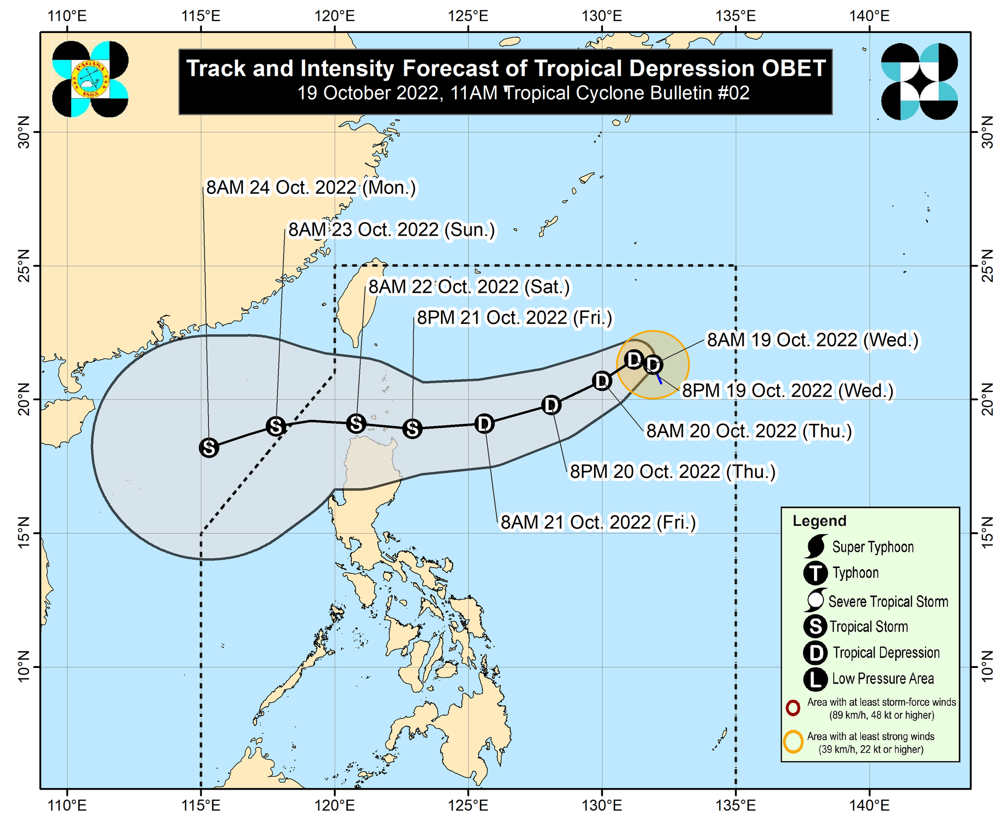
At 10 a.m., Obet was located 1,025 kilometers east of extreme Northern Luzon packing maximum sustained winds of 45 kilometers per hour near the center and gustiness of up to 55 km/h while moving north northwestward at 15 km/h.
From Thursday early morning through Friday morning, it is expected to slow down west northwestward or northwestward until Wednesday evening before it speeds up southwestward or west southwestward.
From Friday afternoon through Saturday, Obet will go westward heading towards northern Luzon or the Luzon Strait.
Obet may traverse extreme Northern Luzon or the northern portion of mainland Northern Luzon between Friday evening and Saturday morning.
From Friday early morning through Saturday morning, moderate to heavy with at times intense rains may be experienced over Babuyan Islands, Ilocos Norte, Apayao, and the northern portion of mainland Cagayan.
Light to moderate with at times heavy rains are possible over Batanes, the northern portion of Ilocos Sur, Abra, Kalinga, and the rest of mainland Cagayan during the same period.
From Saturday morning to afternoon, light to moderate with at times heavy rains over Batanes, Babuyan Islands, Apayao, Ilocos Norte, and the northern portions of Abra and Ilocos Sur.
“Under these conditions, flooding and rain-induced landslides are possible, especially in areas that are highly or very highly susceptible to these hazard as identified in hazard maps and in localities with significant antecedent rainfall, PAGASA said.
Obet is seen to gradually intensify and may reach the tropical storm category by late Friday or early Saturday and may intensify further once it reaches the West Philippine Sea, it added. — VBL, GMA News
