

PAGASA: Chedeng intensifies into severe tropical storm
Chedeng has intensified into a severe tropical storm Wednesday evening, according to state weather bureau PAGASA.
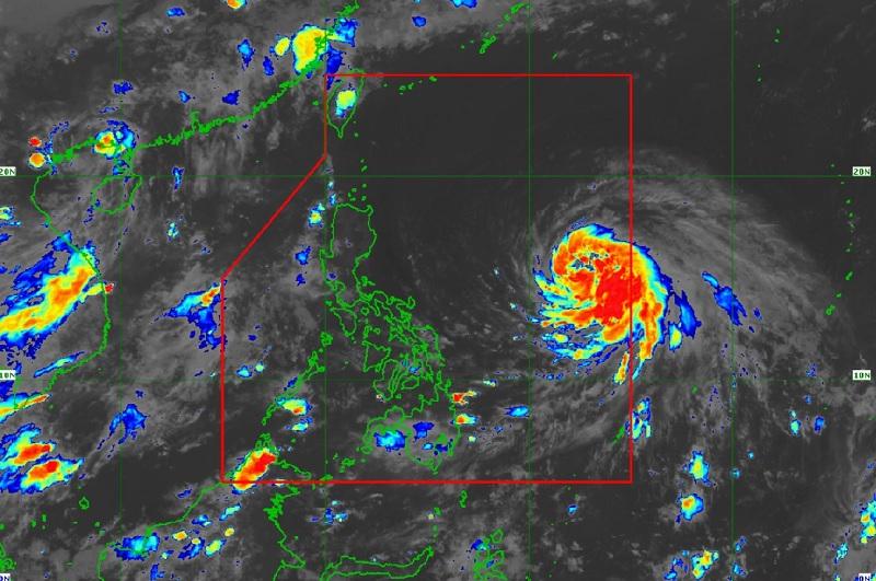
In its 11 p.m. Tropical Cyclone Bulletin, PAGASA said the center of the tropical cyclone was last seen 1,220 kilometers east of Southeastern Luzon.
It is heading west-northwestward at a speed of 10 kilometers per hour (km/h) with maximum sustained winds of 95 km/h near the center, gustiness of up to 115 km/h, and a central pressure of 992 hPa.
The Severe Tropical Storm also has strong gale-force winds that extend outwards up to 350 km from the center, the agency added.
Chedeng may have further strengthened but it will not have any direct effect on the Philippines.
Heavy rainfall outlook
PAGASA said the tropical cyclone will not spur heavy rainfall in any portion of the country in the next three to five days and will not cause rough sea conditions in the next 24 hours.
Chedeng is expected to develop into a typhoon by Thursday and may reach peak intensity by Friday or Saturday.
Severe Winds
The enhancement of the Southwest Monsoon over the next 3 days may bring gusty conditions over the following areas (especially in coastal and upland/mountainous localities exposed to winds):
On Friday, frequent gusts over Kalayaan Islands; intermittent to occasional wind gusts over Visayas, Romblon, Oriental Mindoro, the northern portion of Palawan including Calamian and Cuyo Islands, Surigao del Norte, Dinagat Islands, and Camiguin.
By Saturday, frequent gusts over Romblon and Kalayaan Islands; intermittent to occasional gusts over the Visayas, CALABARZON, Bicol Region, the rest of MIMAROPA, Camiguin, and Dinagat Islands.
Hazards affecting coastal waters
Tropical Storm Chedeng remains unlikely to cause rough sea condition over the coastal waters of the country in the next 24 hours.
Track and Intensity Outlook
On the forecast track, the weather disturbance will remain far from the Philippine landmass.
It is seen to move generally west-northwestward or northwestward Wednesday evening through mid-Friday before beginning to slow down while turning northward.
Chedeng will begin to accelerate north-northeastward or northeastward by Sunday and may exit the Philippine Area of Responsibility or PAR between late Sunday and early Monday. -- BAP, GMA Integrated News
