
Typhoon Chedeng further intensifies, remains far from landmass
Typhoon Chedeng has further intensified but will remain far from the Philippine landmass, according to state weather bureau PAGASA Thursday evening.
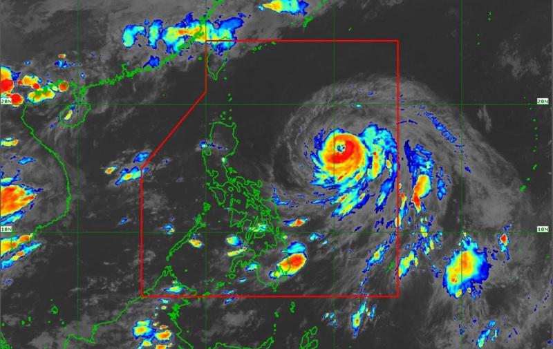
In its 11 p.m. forecast, PAGASA said no storm signal was raised in any part of the country due to the typhoon.
However, the typhoon may enhance the prevailing southwest monsoon (habagat) and may bring occasional rains over some portions of southwestern Luzon in the next three days.
Chedeng is also not seen to cause rough sea conditions over the country’s coastal waters in the next 24 hours but the enhanced habagat may bring gusty conditions over the following areas in the next three days: Visayas, Romblon, Occidental Mindoro, the northern portion of Palawan including Kalayaan, Calamian, and Cuyo Islands, Surigao del Norte, Dinagat Islands, and Camiguin.
As of 10 p.m., the center of the eye of the typhoon was estimated at 905 kilometers east of Central Luzon and is moving west-northwestward at 10 kilometers per hour (km/h), packing maximum sustained winds of 130 km/h near the center and gustiness of up to 160 km/h.
On the forecast track, Chedeng will remain far from the Philippine landmass. It is forecast to turn generally northwestward on Friday, then northward or north-northeastward on Saturday.
It will then accelerate north-northeastward or northeastward and may leave the Philippine Area of Responsibility on Sunday evening or Monday morning.
PAGASA also said that Chedeng may reach its peak intensity Friday or on Saturday. It will begin to weaken as it moves further away from the country on Sunday.
As it enters a more subtropical region during this period, the typhoon will begin its post-tropical transition by Monday. -- BAP, GMA Integrated News
