
Chedeng to enhance Habagat; to bring occasional rains over parts of Luzon
Typhoon Chedeng is expected to enhance the Southwest Monsoon that will bring occasional rains over some portions of southwestern Luzon in the next three days, state weather bureau PAGASA said Friday.
In its 11 a.m. bulletin, PAGASA said Chedeng will boost the Southwest Monsoon that may also cause gusty conditions in coastal and mountainous areas.
These may be experienced particularly in Romblon, Occidental Mindoro, the northern portion of Palawan including Kalayaan, Calamian, and Cuyo Islands, Surigao del Norte, Dinagat Islands, and Camiguin on Friday.
Same conditions are expected on Saturday in Mimaropa, Western Visayas, Bicol, Calabarzon, Metro Manila, Ilocos Region, Northern Samar, Zambales, Bataan, Bulacan, Aurora, and Benguet.
Due to Chedeng, moderate to rough seas up to 3.5 meters may be experienced over the seaboards of Extreme Northern Luzon and the eastern seaboard of mainland Northern Luzon.
PAGASA reminded mariners of small seacrafts to take precautionary measures when venturing out to sea.
The agency also advised concerned public and disaster risk reduction and management offices to take all necessary measures to protect life and property.
Residents in areas prone to hazards are advised to follow evacuation and other instructions from local officials, PAGASA said.
The hoisting of Wind Signals is unlikely for now, according to PAGASA.
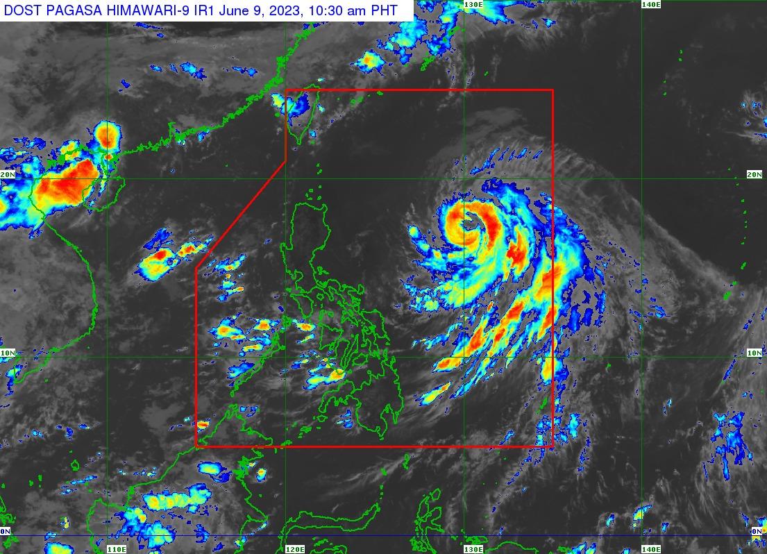
At 10 a.m., Chedeng was located 920 km east of Northern Luzon packing maximum sustained winds of 130 kilometers per hour (km/h), gustiness of up to 160 km/h, and central pressure of 975 hPa.
Chedeng’s strong to typhoon-force winds extend outwards up to 520 km from the center.
The typhoon was moving north northwestward at 10 km/h.
Chedeng will remain far from the Philippine landmass and is now approaching the period where it will be closest to the country, according to PAGASA.
It is expected to move northwestward in the next 12 hours before turning generally north or northeastward on Saturday.
Chedeng on Sunday will then accelerate while moving northeastward towards the sea south of Japan.
PAGASA said the typhoon may exit the Philippine Area of Responsibility (PAR) on Monday. —Joviland Rita/ VAL GMA Integrated News
