
Signal No. 1 up over 12 areas due to Aghon
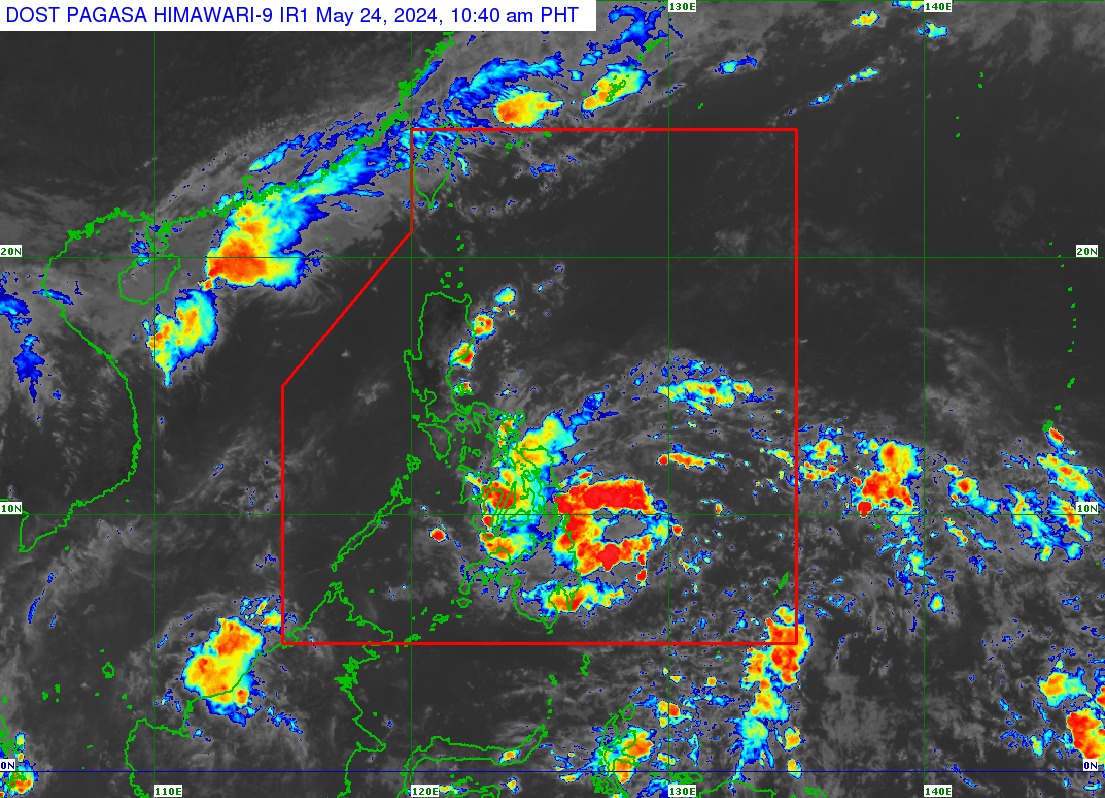
Twelve areas are under Tropical Cyclone Wind Signal (TCWS) No. 1 as Tropical Depression Aghon approaches Eastern Visayas, state weather bureau PAGASA said on Friday.
In its latest bulletin, PAGASA said the following areas are under TCWS No. 1:
- Sorsogon
- Albay (Manito, Legazpi City, City of Tabaco, Rapu-Rapu, Santo Domingo, Malilipot, Bacacay, Malinao, Tiwi)
- Catanduanes
- Camarines Sur (Caramoan, Garchitorena, Presentacion, Sagñay, San Jose, Lagonoy, Tigaon)
- Eastern Samar
- Samar
- Northern Samar
- Leyte (Babatngon, Tacloban City, Palo, Tanauan, Tolosa, Dulag, Mayorga, Macarthur, Abuyog, Javier)
- Southern Leyte (Silago, Hinunangan, Hinundayan, Anahawan, San Juan, Liloan, Saint Bernard, San Ricardo, Pintuyan, San Francisco)
- Dinagat Islands
- Surigao del Norte including Siargao - Bucas Grande Group
- Surigao del Sur (Carrascal, Cantilan, Madrid, Carmen, Lanuza, Cortes, City of Tandag)
As of 11 a.m., PAGASA said Aghon was located 240 kilometers east of Hinatuan, Surigao del Sur with maximum sustained winds of 45 kilometers per hour, gustiness of up to 55 km/h, and central pressure of 1006 hPa.
Aghon’s strong winds extend outwards up to 220 km from the center.
It was moving west northwestward at 10 km/h
Impact
An accumulated rainfall of 100 to 200 millimeters may be experienced in Eastern Samar, Southern Leyte, Surigao del Norte, and Dinagat Island.
Meanwhile, 50 to 100 mm of accumulated rainfall is expected in Surigao del Sur, the rest of Eastern Visayas, Albay, Sorsogon, Masbate including Ticao and Burias Islands, Catanduanes, and the eastern portion of Camarines Sur.
“Forecast rainfall are generally higher in elevated or mountainous areas,” PAGASA said.
“Under these conditions, flooding and rain-induced landslides are possible especially in areas that are highly or very highly susceptible to these hazards as identified in hazard maps and in localities that experienced considerable amounts of rainfall for the past several days,” it added.
Minimal to minor impacts from strong winds are possible within any of the areas under TCWS No. 1, according to PAGASA.
Moderate to rough seas up to 3.0 meters are expected over the coastal waters along the northern and eastern seaboards of Eastern Visayas and the eastern seaboard of Caraga Region.
“Mariners of motor bancas and similarly-sized vessels are advised to take precautionary measures while venturing out to sea and, if possible, avoid navigating in these conditions, especially if inexperienced or operating ill-equipped vessels,” PAGASA said.
Movement
Aghon may move generally west northwestward or northwestward from Friday to Saturday while slowly intensifying.
The tropical depression may intensify into a tropical storm and make a close approach or make landfall in the vicinity of Eastern Visayas on Saturday morning.
“Considering the trend in the westward shift in the track forecast of AGHON and the forecast probability cone, a slightly earlier landfall over Eastern Visayas and a direct passage in the vicinity of Bicol Region is not ruled out at this time,” PAGASA said.
—VAL, GMA Integrated News
