
Signal No. 1 up in 19 areas due to Aghon
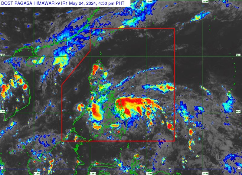
Storm Signal Number 1 remains hoisted over 19 areas as Tropical Depression Aghon continues to move west northwestward over the waters off east Mindanao, according to PAGASA on Friday afternoon.
At 4 p.m., the center of the tropical cyclone was spotted 135 kilometers northeast of Hinatuan, Surigao del Sur or 185 km east southeast of Surigao City, Surigao del Norte.
Aghon was moving west northwestward at 30 km/h while packing maximum sustained winds of 55 km/h near the center and gustiness of up to 70 km/h.
PAGASA said Tropical Cyclone Wind Signal (TCWS) No. 1 is up over the following areas:
Luzon
- Sorsogon
- Albay
- Catanduanes
- Camarines Sur
- Camarines Norte (San Vicente, San Lorenzo Ruiz, Basud, Daet, Talisay, Mercedes)
- Masbate including Ticao and Burias Islands
Visayas
- Eastern Samar
- Samar
- Northern Samar
- Leyte
- Southern Leyte
- Biliran
- Cebu (San Remigio, Tabogon, City of Bogo, Medellin, Daanbantayan, Bourbon) including Camotes Islands, Bantayan Island
- Bohol (Pres. Carlos P. Garcia, Bien Unido, Trinidad, Anda, Candijay, Ubay, Mabini, Alicia, San Miguel, Talibon)
Mindanao
- Dinagat Islands
- Surigao del Norte including Siargao and Bucas Grande Islands
- Surigao del Sur
- Agusan del Sur (Sibagat, City of Bayugan, Prosperidad, San Francisco, Rosario, Bunawan, Trento)
- Agusan del Norte
Winds of 39-61 km/h and intermittent rains may be expected in the affected areas for at least 36 hours, the weather bureau said.
Minimal impacts, including very light or no damage to low-risk structures; slight damage to some houses made of very light materials or makeshift structures in exposed communities; and light damage to medium- to high-risk structures, may also be expected.
Accumulated rains of around 100 to 200 mm may be experienced over Albay, Sorsogon, Eastern Visayas, Surigao del Norte, and Dinagat Islands on Friday to Saturday afternoon.
At least 50 to 100 mm of accumulated rain may also affect the southern portion of Quezon, Masbate, including Ticao and the Burias Islands, Catanduanes, the eastern portion of Camarines Sur, Western Visayas, Surigao del Sur, and Zamboanga del Norte.
Meanwhile, PAGASA said Aghon will bring moderate to rough seas (1.5 to 3.5 m) over the coastal waters along the northern and eastern seaboards of Eastern Visayas and the eastern seaboard of Caraga Region.
“Mariners of motor bancas and similarly-sized vessels are advised to take precautionary measures while venturing out to sea and, if possible, avoid navigating in these conditions, especially if inexperienced or operating ill-equipped vessels,” it added.
On the forecast track, Aghon may intensify into a severe tropical storm by Sunday and into a typhoon by Monday. It may make landfall over the southern portion of Eastern Samar or Dinagat Islands by Saturday morning as a tropical storm before passing north northwestward through the coast of Northern Samar.
It may possibly make another landfall over the southeastern portion of the Bicol Region (Sorsogon, Albay, or Catanduanes) by Saturday evening as a tropical storm. —VBL, GMA Integrated News
