
Signal No. 1 in 20 areas as Aghon moves west northwest
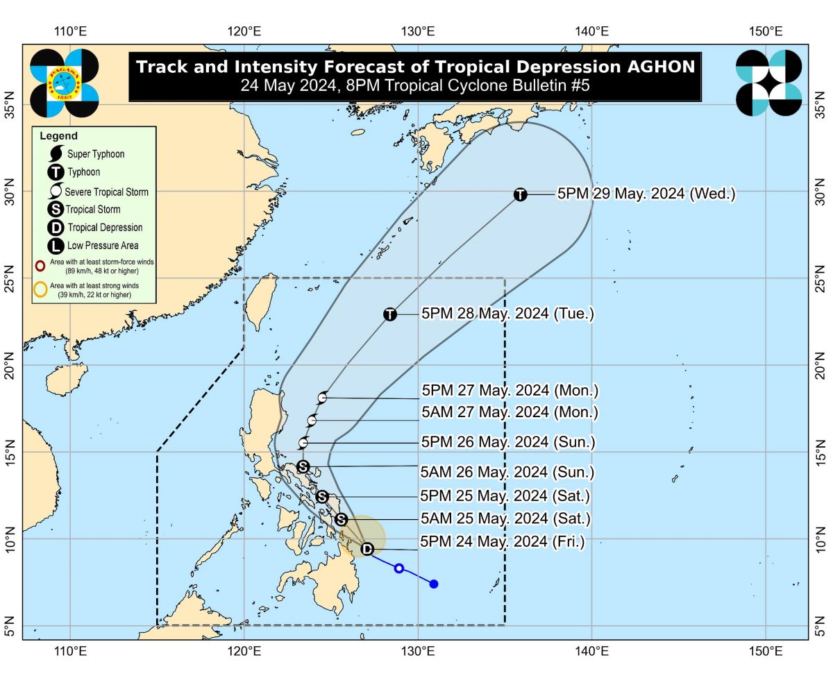
Tropical Depression Aghon continues to move west northwestward over the waters off Eastern Mindanao, PAGASA said in its bulletin issued at 8 p.m. Friday.
PAGASA said 20 areas were under Tropical Cyclone Wind Signal No. 1:
Luzon
- Quezon (Calauag, Guinayangan, Lopez, Buenavista, Catanauan, Mulanay, San Narciso, San Francisco, San Andres, Tagkawayan)
- Sorsogon
- Albay
- Catanduanes
- Camarines Sur
- Camarines Norte
- Masbate including Ticao Island, and Burias Island
Visayas
- Eastern Samar
- Samar
- Northern Samar
- Leyte
- Southern Leyte
- Biliran
- Cebu (San Remigio, Tabogon, City of Bogo, Medellin, Daanbantayan, Borbon) including Camotes Islands, Bantayan Island
- Bohol (Pres. Carlos P. Garcia, Bien Unido, Trinidad, Anda, Candijay, Ubay, Mabini, Alicia, San Miguel, Talibon)
Mindanao
- Dinagat Islands
- Surigao del Norte including Siargao and Bucas Grande Islands
- Surigao del Sur
- Agusan del Sur (Sibagat, City of Bayugan, Prosperidad, San Francisco, Rosario, Bunawan, Trento)
- Agusan del Norte
At 7 p.m., the center of the eye was located 145 kilometers east of Surigao City, Surigao del Norte.
Aghon was heading northwestward at 20 km/h while packing maximum sustained winds of 55 km/h near the center and gustiness of up to 70 km/h.
Meanwhile, moderate to rough seas (1.5 to 3.5 m) may prevail over the coastal waters along the northern and eastern seaboards of Eastern Visayas and the eastern seaboard of Caraga Region due to Aghon.
“Mariners of motor bancas and similarly-sized vessels are advised to take precautionary measures while venturing out to sea and, if possible, avoid navigating in these conditions, especially if inexperienced or operating ill-equipped vessels,” said PAGASA.
On the forecast track, Aghon is forecast to make landfall over the southern portion of Eastern Samar or Dinagat Islands by Saturday morning as a tropical storm before passing north northwestward through the coast of Northern Samar.
It may possibly make another landfall over the southeastern portion of Bicol Region (Sorsogon, Albay, or Catanduanes) by Saturday evening as a tropical storm.
The tropical cyclone will begin recurving generally northward or north northeastward over the waters east of Luzon while starting to continuously intensify.
The current forecast scenario shows intensification into a severe tropical storm by Sunday and into a typhoon by Tuesday. —VBL, GMA Integrated News
