
Signal No. 1 in 20 areas as Aghon heads to Leyte Gulf
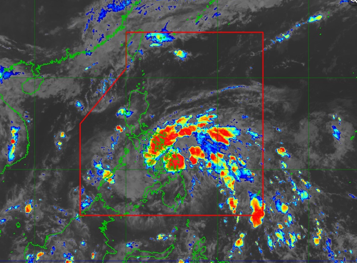
Tropical Depression Aghon continues to move northwestward at 20 kph towards the Leyte Gulf, PAGASA said in its 11 p.m. cyclone bulletin on Friday.
Aghon was last seen 145 km East of Surigao City, Surigao del Norte with maximum sustained winds of 55kph near the center and gustiness of up to 70 kph.
Tropical Cyclone Wind Signal 1 has been raised over the following areas:
- The southeastern portion of Quezon (Calauag, Guinayangan, Lopez, Buenavista, Catanauan, Mulanay, San Narciso, San Francisco, San Andres, Tagkawayan)
- Camarines Norte
- Camarines Sur
- Catanduanes
- Albay
- Sorsogon
- Masbate including Burias and Ticao Islands
- Northern Samar
- Samar
- Eastern Samar
- Leyte
- Southern Leyte
- Biliran
- the extreme northern portion of Cebu (San Remigio, Tabogon, City of Bogo, Medellin, Daanbantayan, Borbon) including Camotes Bantayan Islands and
- the northeastern portion of Bohol (Pres. Carlos P. Garcia, Bien Unido, Trinidad, Anda, Candijay, Ubay, Mabini, Alicia, San Miguel, Talibon)
- Dinagat Islands
- Surigao del Norte including Siargao and Bucas Grande Islands
- Surigao del Sur
- Agusan del Norte
- The eastern portion of Agusan del Sur (Sibagat, City of Bayugan, Prosperidad, San Francisco, Rosario, Bunawan, Trento)
Winds of 39 kph up to 61 kph and intermittent rains may be expected within 36 hours in the following areas, and may cause minimal to minor impacts in affected areas.
Meanwhile, accumulated heavy rainfall has been forecast over parts of the country from Friday night to Saturday night.
- 100-200 mm: Bicol Region
- 50-100 mm: Polillo Islands, the southern portion of Quezon, and Northern Samar
- Forecast accumulated rainfall: From Sunday evening to Monday evening
- 50-100 mm: Catanduanes, Camarines Norte, Camarines Sur and the southern portion of Quezon and Polillo Islands
Aghon is also predicted to bring moderate to rough seas over the coastal waters along the seaboards of Bicol Region, the southern seaboard of Quezon, the eastern seaboard of Eastern Visayas, the western seaboard of Samar and Northern Samar, and the eastern seaboard of Caraga Region.
The cyclone may make landfall over Eastern Samar or the vicinity of Leyte and Dinagat Islands within the next 12 hours as a tropical depression, depending on the track of the typhoon.
It is anticipated to reach the tropical storm category as it passes the Bicol Region an intensify into a typhoon before it exits the Philippine Area of Responsibility no later than Tuesday. —NB, GMA Integrated News
