

Typhoon Aghon continues to move northeastward over PH Sea— PAGASA
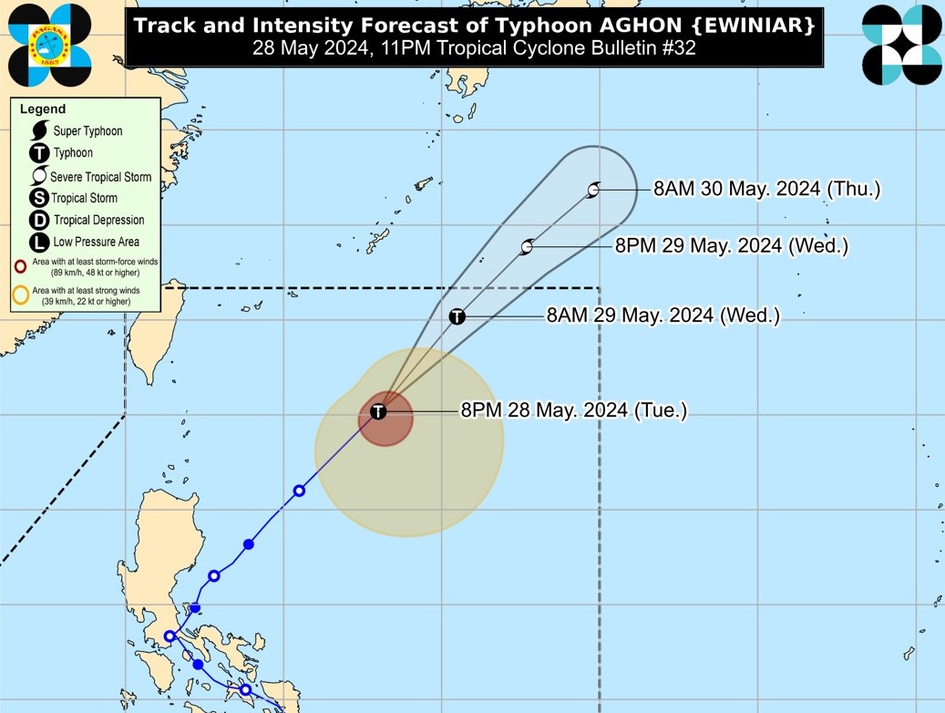
Typhoon Aghon continues to move northeastward over the Philippine Sea on Tuesday evening, according to PAGASA.
The center of the eye of Aghon was estimated at 690 km east northeast of Basco, Batanes. It is heading northeastward at 30 km/h while packing maximum sustained winds of 130 km/h near the center and gustiness of up to 160 km/h.
The state weather bureau said Aghon is unlikely to directly bring significant amount of rainfall within the next three days but the southwesterly windflow partly influenced by the tropical cyclone may trigger moderate to heavy rains over the western portions of Central Luzon and Mimaropa in the next two days.
The southwesterly windflow may also bring moderate to rough seas (1.0 to 3.0 m) over the coastal waters of Batanes, Babuyan Islands, mainland Cagayan, and Ilocos Norte.
“Mariners of motorbancas and similarly-sized vessels are advised to take precautionary measures while venturing out to sea and, if possible, avoid navigating in these conditions, especially if inexperienced or operating ill-equipped vessels,” said PAGASA.
On the forecast track, PAGASA said Aghon is expected to generally move northeastward over the Philippine Sea for the entirety of the forecast period and exit the Philippine Area of Responsibility (PAR) Wednesday morning or afternoon. —Sundy Locus/RF, GMA Integrated News
