

LPA inside PAR has ‘high’ potential to become tropical depression - PAGASA
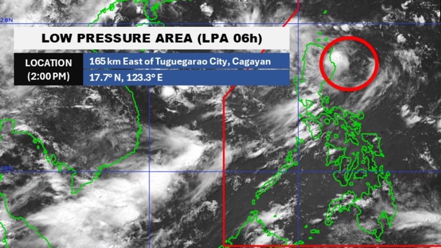
The state weather bureau on Wednesday afternoon is monitoring the low pressure area (LPA) inside the Philippine Area of Responsibility (PAR) which has a “high” potential to develop into a tropical depression within the next 24 hours.
It will be given the local name "Bising" once it becomes a tropical depression, the second storm to hit the country this year, said PAGASA weather specialist John Manalo.
As of 3 p.m., the LPA was located 155 kilometers east of Tuguegarao City, Cagayan.
“Due to the LPA's close proximity to the land mass, hoisting of Tropical Cyclone Wind Signal #1 is possible along the eastern sections of Northern and Central Luzon as soon as it develops into a Tropical Depression,” said PAGASA.
Meanwhile, another tropical depression that was monitored earlier is outside of PAR at 2,615 km east northeast of Itbayat Batanes. It has winds of 55 kilometres per hour and gustiness of 70 kph. It is moving northwestward at 15 kph.
PAGASA earlier said that two or three cyclones may form inside PAR in July. These cyclones have a chance of making landfalls in the Visayas or Central Luzon or pass near Batanes. —Vince Angelo Ferreras/RF, GMA Integrated News
