

PAGASA watching 3 LPAs outside PAR; more rains on Friday
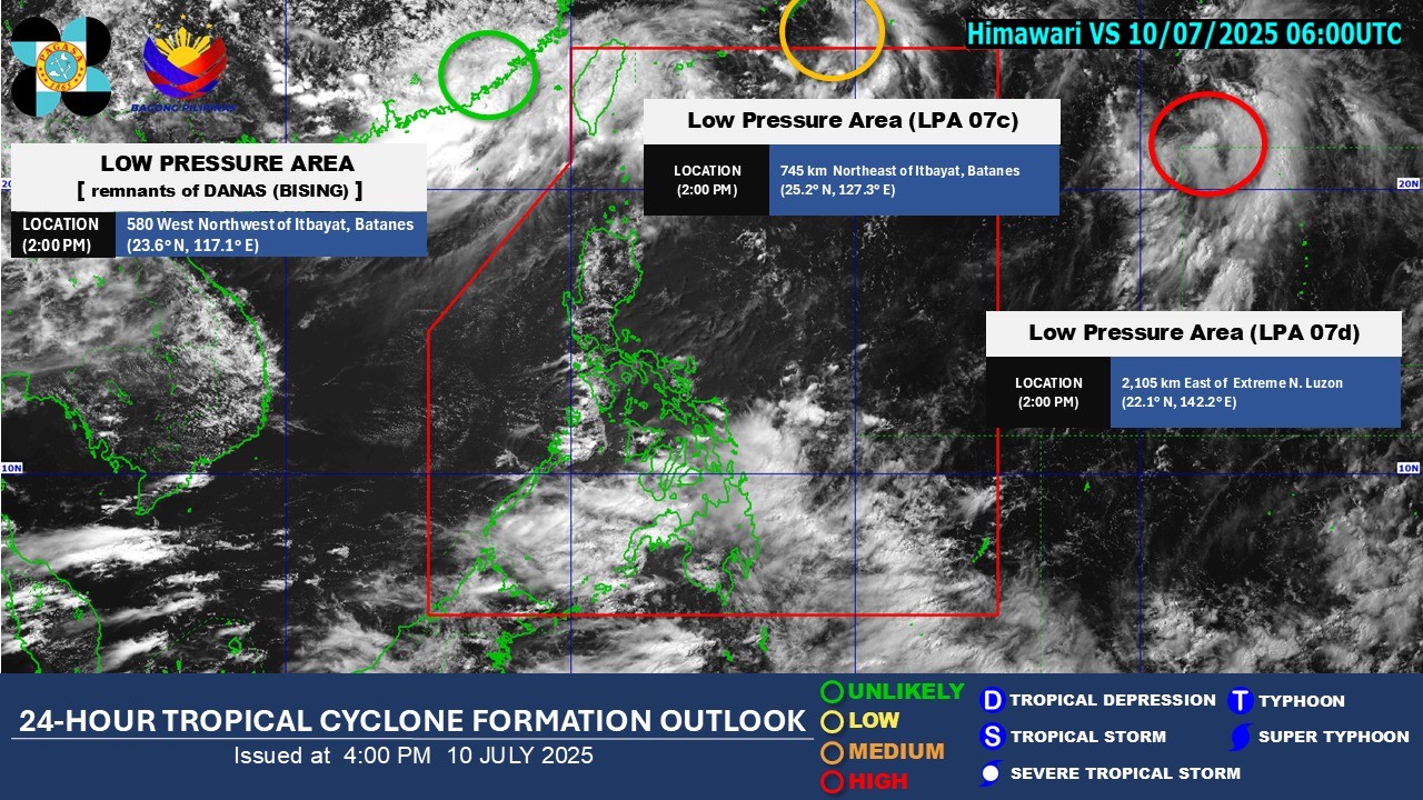
PAGASA said Thursday afternoon it continues to monitor three Low Pressure Areas (LPA) outside the Philippine Area of Responsibility (PAR).
As of 2 p.m., the state weather bureau reported that one of the LPAs had a medium potential of becoming a tropical depression within the next 24 hours, while another had a high potential
The third LPA, which was a remnant of Tropical Depression Danas (formerly Bising), is also being monitored outside the PAR and is unlikely to become a tropical depression within the next 24 hours.
PAGASA’s daily weather forecast on Friday afternoon also reported that the Southwest Monsoon or Habagat continues to bring rains over different parts of the country.
The monsoon is predicted to cause occasional rains over Zamboanga Peninsula, and cloudy skies with scattered rains and thunderstorms over Metro Manila, Visayas, the rest of Mindanao, Batanes, Babuyan Islands, Zambales, Bataan, Cavite, Batangas, Occidental Mindoro, and Palawan.
The rest of the country will have partly cloudy to cloudy skies with isolated rain showers or thunderstorms due to the effects of the monsoon.
Possible flash floods or landslides may occur in some areas as a result of said weather conditions.
Meanwhile, the northern and western sections of Luzon will be having moderate to strong winds with moderate to rough waters, while the rest of the country will be having light to moderate winds with slight to moderate coastal waters.
Sunrise in Metro Manila will be at 5:34 a.m. on Friday. — Jiselle Anne Casucian/RF, GMA Integrated News
