

LPA outside PAR now a tropical depression —PAGASA
The low pressure area (LPA) being monitored outside the Philippine area of responsibility (PAR) is now a tropical depression, state weather bureau PAGASA said on Friday.
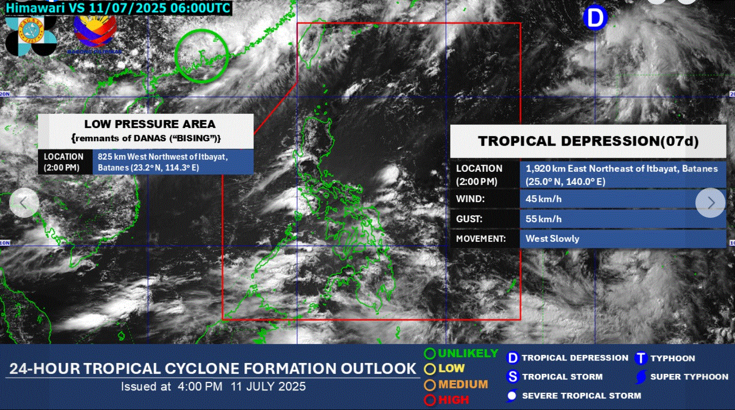
PAGASA said the tropical depression was located 1,920 kilometers east northeast of Itbayat, Batanes as of 2 p.m.
The tropical cyclone has a wind of 45 kilometers per hour and gustiness of 55 kilometers per hour, moving west slowly.
Meanwhile, another LPA, which is a remnant of Tropical Cyclone Bising (international name: Danas), remained outside the PAR and is unlikely to redevelop into a tropical depression within the next 24 hours.
PAGASA said in its 24-hour public weather forecast that the Southwest Monsoon or habagat is expected to affect the country.
Occasional rains are expected over Western Visayas, Negros Island Region, Palawan, and Occidental Mindoro. Flash floods or landslides are possible due to moderate to heavy rains.
Cloudy skies with scattered rains and thunderstorms may be experienced in Metro Manila, Mindanao, the rest of Visayas, Batanes, Babuyan Islands, Zambales, Bataan, Cavite, and Batangas. Flash floods or landslides may occur amid moderate to at times heavy rains.
Also, partly cloudy to cloudy skies with isolated rain showers or thunderstorms are expected over the rest of Luzon. Flash floods or landslides may happen during severe thunderstorms.
Sunrise on Saturday is at 5:34 a.m. —Joviland Rita/LDF, GMA Integrated News
