

PAGASA: LPA outside PAR develops into tropical depression
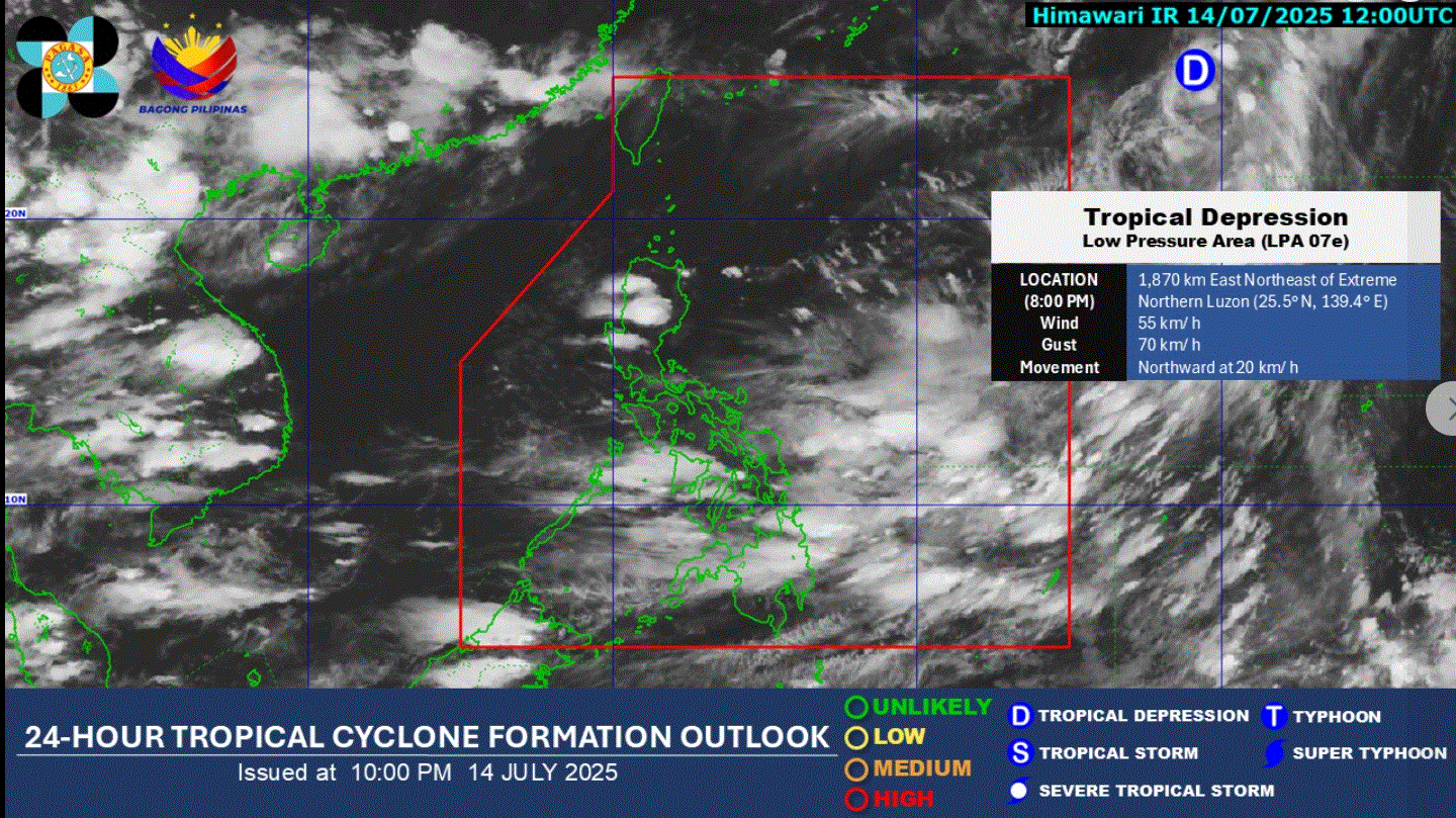
The low pressure area (LPA) being monitored outside the Philippine area of responsibility has developed into a tropical depression as of 8 p.m. Monday, PAGASA said.
The state weather bureau said the cyclone was spotted 1,870 kilometers east northeast of extreme Northern Luzon.
It packs maximum sustained winds of 55 kilometers per hour near the center and gustiness of up to 70 km/h.
It is moving northward at 20 km/h.
In its 4 p.m. weather bulletin, PAGASA said the Southwest Monsoon or habagat will bring cloudy skies with scattered rains in Western Visayas, Negros Island Region, Zamboanga Peninsula, Northern Mindanao, Occidental Mindoro, Romblon, and Palawan.
Metro Manila and the rest of the country will experience partly cloudy to cloudy skies with isolated rainshowers or thunderstorms due to the habagat.
The sun will rise at 5:35 a.m. —LDF, GMA Integrated News
