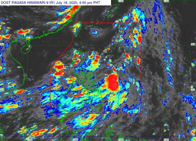
Wind signal possible Wednesday night or Thursday due to Crising

Signal No. 1 may be raised over portions of Cagayan on Wednesday night or early Thursday morning due to Tropical Depression Crising, PAGASA said in its 5 p.m. bulletin.
At 4 p.m., Crising was located 625 kilometers east of Virac, Catanduanes, with maximum sustained winds of 45 km/h near the center and gustiness of up to 55 km/h.
It was moving west southwestward at 20 km/h.
''Should Crising maintain its westward movement or increase its radius, the possibility of raising Tropical Cyclone Wind Signal No. 1 over Catanduanes is also not ruled out. Furthermore, the highest Wind Signal which may be hoisted during the occurrence of Crising is Wind Signal No. 3 or 4," PAGASA said.
Meanwhile, the Southwest Monsoon (Habagat) will bring strong to gale-force gusts over the following areas:
- Wednesday: Palawan, Siquijor, Bohol, Camiguin, Southern Leyte, Surigao del Norte, and Dinagat Islands
- Thursday: Batangas, Quezon, Bicol Region, MIMAROPA, Visayas, Zamboanga del Norte, Camiguin, Surigao del Norte, Dinagat Islands, Davao Occidental, and Davao Oriental.
- Friday: Bataan, Metro Manila, CALABARZON, Bicol Region, MIMAROPA, Visayas, Zamboanga Peninsula, Basilan, Sulu, Tawi-Tawi, Misamis Occidental, Lanao del Norte, Camiguin, Surigao del Norte, Dinagat Islands, Davao Occidental, and Davao Oriental
In the next 24 hours, Crising will cause cloudy skies with scattered rains and thunderstorms over the Bicol Region, Eastern Visayas, Isabela, Aurora, Quezon, Dinagat Islands, and Surigao del Norte.
The Southwest Monsoon will affect the rest of the country.
The next tropical cyclone bulletin will be issued at 11 p.m. Wednesday. —Jiselle Anne Casucian/VBL, GMA Integrated News


