

Signal No. 1 up in 4 areas as TD Crising slightly intensifies
Signal No. 1 was hoisted in four areas as Tropical Depression Crising slightly intensified and may become a tropical storm on Thursday morning, according to PAGASA.
According to its 11 p.m. tropical cyclone bulletin, the state weather bureau said the following areas are under Signal No. 1:
- Southeastern portion of Cagayan (Gattaran, Baggao, Peñablanca)
- Eastern portion of Isabela (Maconacon, Divilacan, Palanan, Dinapigue, San Pablo, Tumauini, Ilagan City, San Mariano, San Guillermo, Benito Soliven, Echague, Jones, San Agustin, Naguilian, City of Cauayan, Angadanan, Gamu, Cabagan, Reina Mercedes)
- Northeastern portion of Aurora (Dilasag, Casiguran, Dinalungan)
- Northeastern portion of Quirino (Maddela)
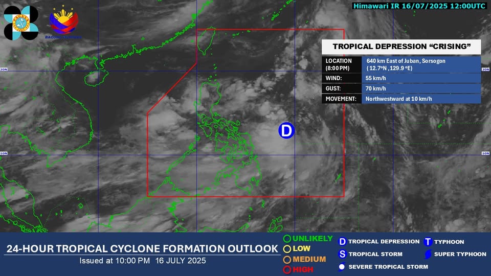
Crising was located 615 kilometers east of Virac, Catanduanes or 630 km of Juban, Sorsogon, with maximum sustained winds of 55 km/h near the center and gustiness of up to 70 km/h.
The storm was moving northwestward at 10 km/h.
PAGASA also warned the public against general wind threat as local winds may be slightly stronger in coastal and upland or mountainous areas exposed to winds.
“Minimal to minor impacts from strong winds are possible within any of the areas under Wind Signal No. 1,” PAGASA said.
It added that the highest wind signal that may be hoisted during the occurrence of Crising is Signal No. 3.
Meanwhile, the Southwest Monsoon will bring strong to gale-force gusts over Batangas, Quezon, Bicol Region, MIMAROPA, Visayas, Zamboanga del Norte, Camiguin, Surigao del Norte, Dinagat Islands, Davao Occidental, and Davao Oriental on Thursday.
PAGASA also said Crising will move generally northwestward over the next 48 hours.
"It may pass close or make landfall over mainland Cagayan or Babuyan Islands from Friday evening to Saturday (19 July) early morning," the agency said.
"Afterwards, it will move west northwestward and may exit the Philippine Area of Responsibility on Saturday afternoon or evening," it added.
Crising is also expected to continue intensifying over the Philippine Sea and may reach the severe tropical storm category on Friday.
"Further intensification up to Typhoon category prior to approach is also not ruled out," PAGASA said. — Mariel Celine Serquiña/RF, GMA Integrated News
