

Crising maintains strength; Signal No. 1 over 9 areas
Tropical Depression Crising maintains its strength while moving west northwestward over the sea east of the Bicol Region as 9 areas are under Signal No. 1 and with the southwest monsoon affecting Mindanao, and the western sections of Luzon and Visayas, according to the Tropical Cyclone Bulletin posted by PAGASA.
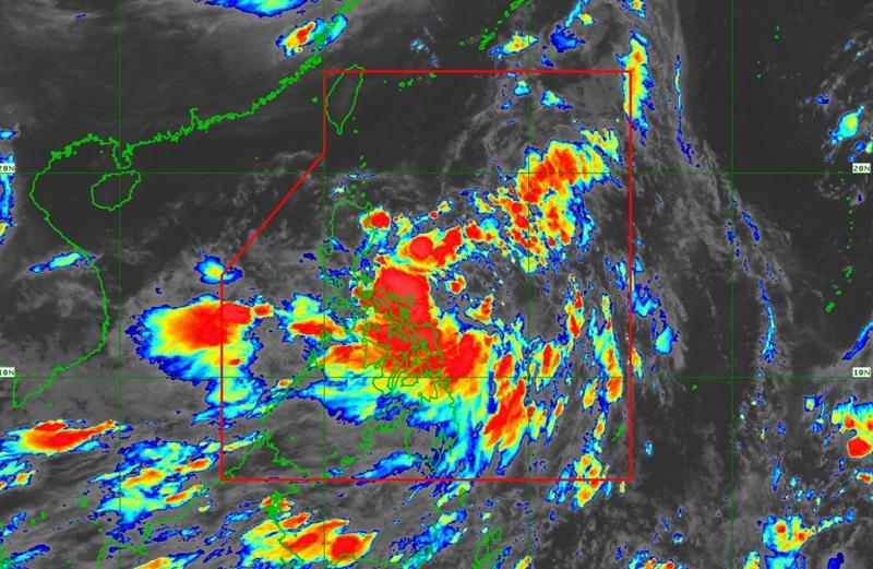
The center of Tropical Depression Crising was estimated at 535 kilometers east of Juban, Sorsogon packing maximum sustained winds of 55 kilometers per hour near the center, gustiness of up to 70 kph and moving west northwestward at 15 kph.
Tropical Cyclone Wind Signal (TCWS) No. 1 is hoisted over the following areas:
- Cagayan including Babuyan Islands
- Isabela
- the northeastern portion of Aurora (Dilasag, Casiguran, Dinalungan, Dipaculao)
- Quirino
- Kalinga
- the eastern portion of Mountain Province (Sadanga, Barlig, Paracelis, Natonin)
- the eastern portion of Ifugao (Alfonso Lista, Aguinaldo, Mayoyao, Banaue, Hingyon, Lagawe, Lamut)
- the northeastern portion of Nueva Vizcaya (Kasibu, Quezon, Bagabag, Diadi)
- Apayao
Forecast weather conditions
Bicol Region, Eastern Visayas, Isabela, Aurora, Quezon, Dinagat Islands, and Surigao del Norte will have cloudy skies with scattered rains and thunderstorms due to Tropical Depression with the possibility that flash floods or landslides will occur due to moderate to heavy rains.
Western Visayas, Negros Island Region, Palawan, and Occidental Mindoro will have occasional rains due to the southwest monsoon with flash floods or landslides possibly occurring due to moderate to heavy rains.
Metro Manila, rest of Central Luzon, rest of CALABARZON, rest of MIMAROPA, Central Visayas, Zamboanga Peninsula, Northern Mindanao, rest of Caraga, La Union, and Pangasinan will have cloudy skies with scattered rains and thunderstorms due to the southwest monsoon with flash floods or landslides occurring due to moderate to at times heavy rains.
The rest of the country will have partly cloudy to cloudy skies with isolated rain showers or thunderstorms due to the southwest monsoon with the possibility that flash floods or landslides will occur during severe thunderstorms.
Forecast Wind and Coastal Water Conditions
Southern Luzon, Visayas, Mindanao, and the western section of Central Luzon will experience moderate wind speed moving in the southwest to west direction while coastal waters will be moderate.
The rest of Luzon will experience light to moderate wind speed moving in the southwest to northwest direction and slight to moderate coastal waters.
Severe Winds
"The wind signals warn the public of the general wind threat over an area due to the tropical cyclone. Local winds may be slightly stronger/enhanced in coastal and upland/mountainous areas exposed to winds. Winds are less strong in areas sheltered from the prevailing wind direction," says PAGASA.
There will be minimal to minor impacts from strong winds within any of the areas under Wind Signal No. 1.
The Southwest Monsoon will bring strong to gale-force gusts over the following areas (especially in coastal and upland areas exposed to winds): Batangas, Quezon, Bicol Region, MIMAROPA, Visayas, Zamboanga del Norte, Camiguin, Surigao del Norte, Dinagat Islands, Davao Occidental, Davao Oriental, and Sarangani.
Coastal Inundation
The weather bureau reported that there is a minimal to moderate risk of life-threatening storm surge with peak heights reaching 1.0 to 2.0 m in the next 48 hours over the low-lying or exposed coastal localities of Cagayan including Babuyan Islands and Isabela.
Hazards affecting coastal waters
There will be rough seas over the following coastal waters: the western seaboard of Palawan; the northern and eastern seaboards of Catanduanes; the northern and western seaboards of Zamboanga del Norte and Camiguin; the southern seaboards of Negros Oriental, Siquijor, Bohol and Southern Leyte; the eastern seaboards of Davao Region; and the western seaboards of Surigao del Norte and Dinagat Islands.
Moderate seas over the following coastal waters: the northwestern seaboard of Occidental Mindoro; the northwestern seaboard of Masbate; the southwestern seaboards of Antique and Negros Occidental; the eastern seaboards of Northern and Eastern Samar.
PAGASA warned that mariners of motorbancas and similarly-sized vessels are advised to take precautionary measures while venturing out to sea and, if possible, avoid navigation under these conditions.
Track and Intensity Outlook
Crising will move generally northwestward over the next 48 hours while landfall is possible over mainland Cagayan on Friday evening to early Saturday morning is possible.
Crising will then move west northwestward across the northern portion of Northern Luzon, and may exit the Philippine Area of Responsibility by Saturday evening or Sunday morning.
"Crising is forecast to reach Tropical Storm category today. It is forecast to continue intensifying over the Philippine Sea and may reach Severe Tropical Storm category on Friday afternoon or evening before its approach to Northern Luzon," said PAGASA. — BAP, GMA Integrated News
