

LPA outside PAR now tropical depression
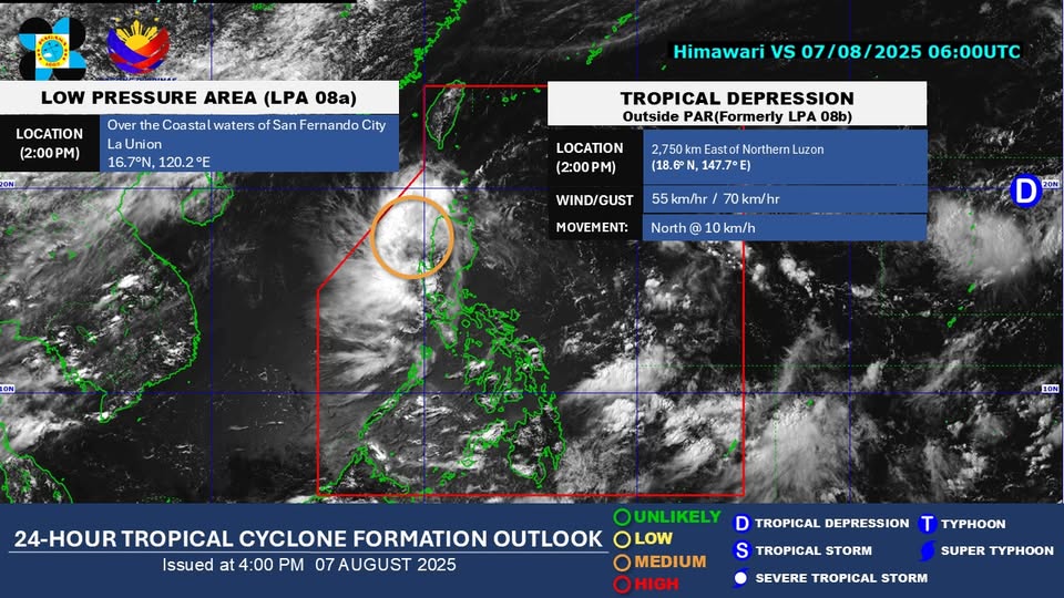
The low pressure area (LPA) outside the Philippine Area of Responsibility (PAR) has developed into a tropical depression, PAGASA said Thursday afternoon.
As of 3 p.m., the tropical depression was located 2,730 kilometers east of Northern Luzon and heading north at 10 km/h.
It has maximum sustained winds of 45 km/h near the center and gustiness of up to 55 km/h.
For now, the LPA inside PAR and the Southwest Monsoon (Habagat) are expected to affect conditions throughout the country.
The LPA spotted over the coastal waters of San Fernando City, La Union has a "medium" chance of becoming a tropical depression within the next 24 hours.
Cloudy skies with scattered to widespread rains and thunderstorms will be observed over the Ilocos Region and Zambales due to the LPA.
These moderate to heavy rains may cause flash floods and landslides.
Metro Manila, Cordillera Administrative Region, Cagayan Valley, the rest of Central Luzon, CALABARZON, Occidental Mindoro, Oriental Mindoro, Marinduque, and Romblon will experience cloudy skies with scattered rains and thunderstorms due to the LPA.
The Habagat will bring the same weather conditions over Visayas, Zamboanga Peninsula, Northern Mindanao, Caraga, Palawan, Albay, Sorsogon, Masbate, and Davao Oriental.
These moderate to at times heavy rains may trigger flash floods and landslides.
Partly cloudy to cloudy skies with isolated rain showers or thunderstorms will persist over the rest of the country due to the Habagat.
These severe thunderstorms may cause flash floods and landslides.
State meteorologists also said Northern Luzon will experience moderate wind and coastal water conditions.
Winds will be light to moderate, while coastal waters will be slight to moderate throughout the rest of the country.
Sunrise in Metro Manila will be at 5:41 a.m. on Friday. — Mariel Celine Serquiña/RF, GMA Integrated News
