

Habagat to bring rains over Luzon; Podul to enter PAR Sunday or Monday
The Southwest Monsoon (Habagat) is affecting the western section of Luzon on Sunday and will bring rains over some areas, PAGASA said.
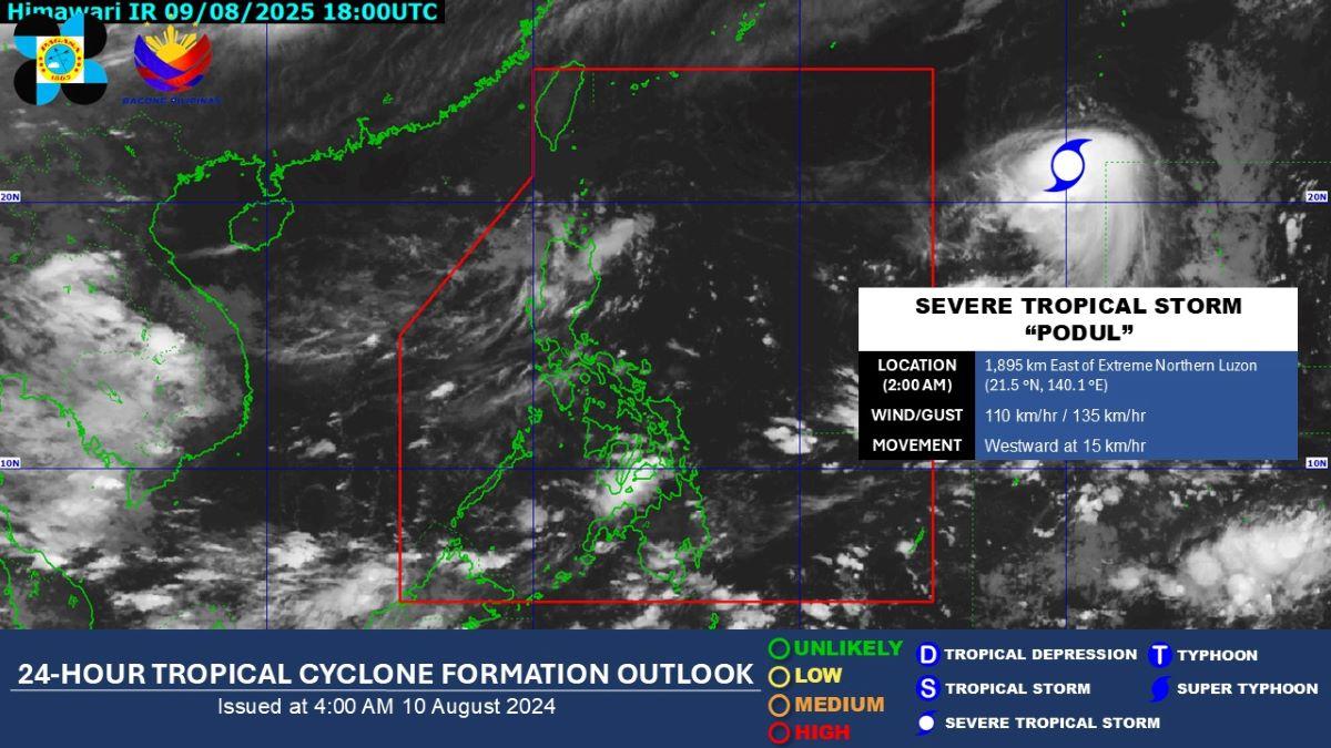
Severe Tropical Storm Podul meanwhile is expected to enter the Philippine Area of Responsibility (PAR) on Sunday night or early Monday morning.
The Ilocos Region, Batanes, and Babuyan Islands will have cloudy skies with scattered rains and thunderstorms due to the monsoon. Moderate to at times heavy rains may possibly result in flash floods or landslides.
Metro Manila, Zambales, Bataan, Cavite, Batangas, Occidental Mindoro, and Palawan may expect partly cloudy to cloudy skies with isolated rain showers or thunderstorms due to the Habagat. During severe thunderstorms, flash floods or landslides may occur.
The rest of the country meanwhile will experience partly cloudy to cloudy skies with isolated rain showers or thunderstorms due to localized thunderstorms. Flash floods or landslides may possibly occur during severe thunderstorms.
Coastal areas will be slight to moderate throughout the whole country.
Sunrise was at 5:41 a.m. while sunset will be at 6:22 p.m.
Podul
Severe Tropical Storm Podul, meanwhile, was located at 3 a.m. at 1,875 km east of Extreme Northern Luzon, which is outside PAR.
It has maximum sustained winds of 110 km/h near the center and gustiness of up to 135 km/h.
Podul is moving westward at 15 km/h.
"Posibleng pumasok ng PAR ito mamayang gabi o bukas ng madaling araw," DOST-PAGASA weather specialist Obet Badrina said in the public weather forecast.
([Podul] may possibly enter PAR tonight or tomorrow early morning.)
Once it enters PAR, it will be called Gorio.
Based on the forecast track, Podul may possibly stay in the northeastern portion of PAR and make landfall in Taiwan on Wednesday before exiting PAR, Badrina said.
"Maliit ang tsansang magkaroon ito ng direkta epekto sa bansa," he said.
(It has a low chance of having a direct effect on the country.)
However, if Podul changes track and goes southward, PAGASA may possibly raise a Tropical Cyclone Warning Signal over Batanes, Badrina said.
"Sa ngayon hindi natin nakikita na masyado nitong palalakasin ang Habagat (For now, we don't see that it will affect the Habagat much)," he added.
"Kaya in general po, makikita pa rin natin 'yung mga generally fair weather sa malaking bahagi ng bansa sa mga susunod na araw," Badrina added.
(So in general, we will see generally fair weather in most parts of the country in the next few days.)
Fabian
Meanwhile, the low pressure area formerly known as Fabian has dissipated as of 2 a.m. Sunday, PAGASA said. —KG, GMA Integrated News
