

Podul on track to enter PAR in next 24 hours
Severe Tropical Storm ”Podul” is expected to enter the Philippine Area of Responsibility (PAR) in the next 24 hours, according to the weather advisory from PAGASA on Sunday morning.
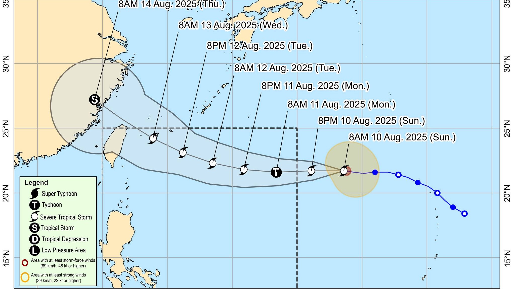
In its 11 a.m. tropical cyclone advisory, the state weather bureau said Podul “continues to accelerate while maintaining its strength”. It will be named "Gorio" once it enters the PAR.
“The center of Severe Tropical Storm PODUL was estimated based on all available data at 1,680 km East of Extreme Northern Luzon (OUTSIDE PAR)”, said PAGASA.
“PODUL is forecast to move generally westward today and tomorrow (11 August), then west northwestward or northwestward from Tuesday (12 August) through the end of the forecast period. PODUL may enter the Philippine Area of Responsibility between tonight and tomorrow early morning,” it added.
PAGASA said Podul has maximum sustained winds of 110 km/h near the center, gustiness of up to 135 km/h, and central pressure of 985 hPa.
The storm’s present movement is westward at 25 km/h while the extent of the tropical cyclone’s winds from strong to storm-force winds extend outwards up to 280 km from the center.
For its general outlook for the forecast period, PAGASA said Podul is “is less likely to directly affect the weather and sea conditions in the country within the next five days.”
“On the track forecast, PODUL may pass close or over the southern Ryukyu Islands on Wednesday (13 August) morning. Furthermore, a landfall scenario over Taiwan on Wednesday afternoon or evening is also not ruled out,” the agency advised.
PAGASA said that that “considering these developments, the public and disaster risk reduction and management offices concerned are advised to continue monitoring for updates related to this tropical cyclone.” — RF, GMA Integrated News