

Huaning slightly accelerates as it heads toward Japan's Ryukyu Islands
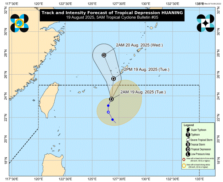
Tropical Depression Huaning gathered speed as it moved toward Japan's Ryukyu Islands, state weather bureau PAGASA said in its cyclone bulletin Tuesday morning.
Huaning is not seen to directly affect the country's land areas or the sea condition in the coastal waters, PAGASA added.
It is forecast to move northward and may exit the Philippine Area of Responsibility in the morning, passing near or over Ryukyu Islands within the day.
The center of the tropical depression was estimated at 650 kilometers east Northeast of Itbayat, Batanes. It is moving north northeastward at 10 kilometers per hour with maximum sustained winds of 55kph and gustiness of up to 70 kph.
Meanwhile, Eastern Visayas, Zamboanga Peninsula, Northern Mindanao, Caraga, and Davao Region will have cloudy skies with scattered rains and thunderstorms due to the easterlies.
The trough of the tropical depression will bring cloudy skies with scattered rains and thunderstorms over Ilocos Norte and Apayao.
Metro Manila and the rest of the country will have partly cloudy to cloudy skies with isolated rainshowers or thunderstorms due to localized thunderstorms. —LDF, GMA Integrated News
