

LPA off S. Luzon has medium chance of becoming tropical cyclone
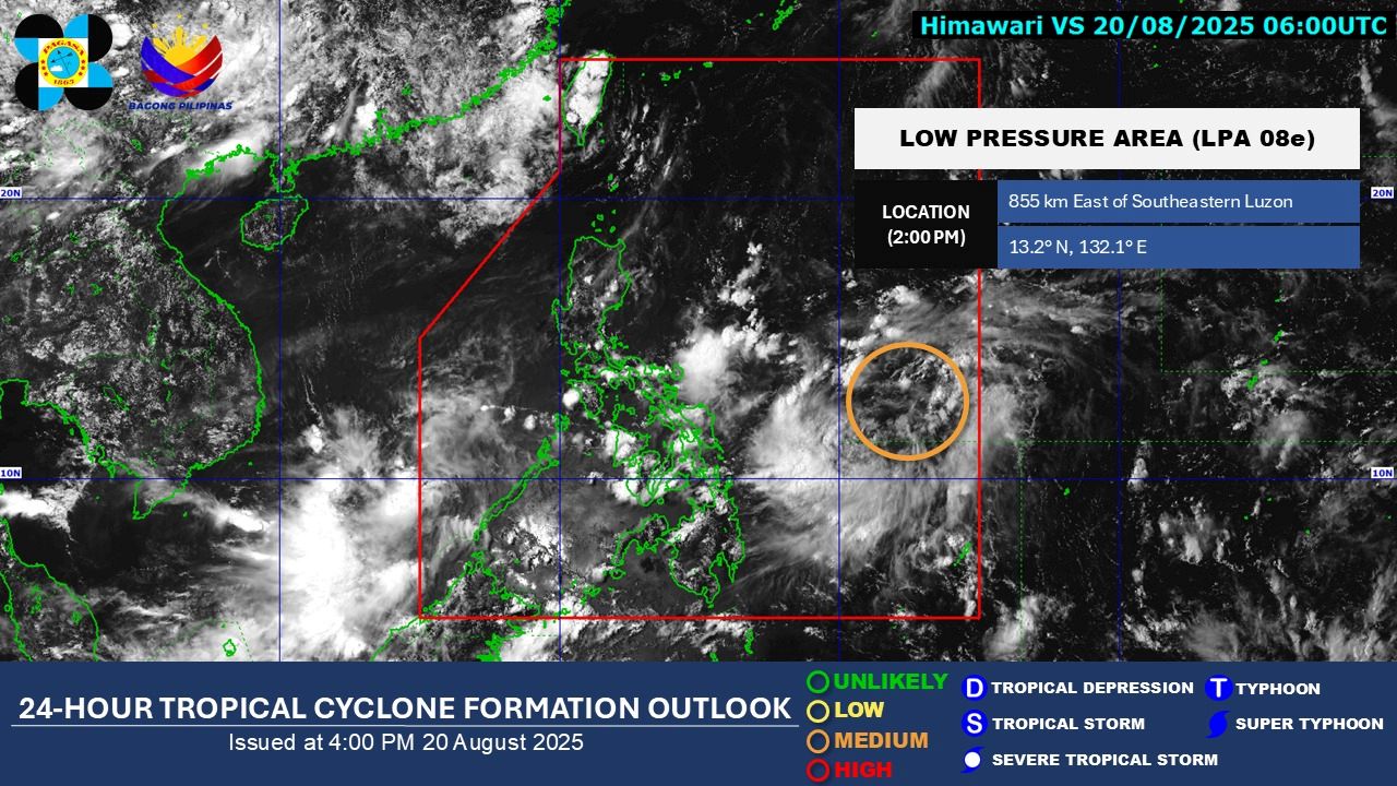
The low pressure area being monitored inside the Philippine Area of Responsibility (PAR) has a “medium” chance of developing into a tropical depression within the next 24 hours, the state weather bureau PAGASA said on Wednesday afternoon.
As of 2 p.m., the LPA was monitored 855 kilometers east of southeastern Luzon.
The LPA will be called "Isang" if it develops into a tropical cyclone, PAGASA weather specialist Benison Estareja said in his 5 p.m. report. On Friday, the weather disturbance will pass through Northern and Central Luzon before leaving PAR on Sunday to head to southern China, he said.
In the next 24 hours, several parts of the country will experience rains due to the Intertropical Convergence Zone (ITCZ) and the easterlies.
According to the forecast issued at 4 p.m., the ITCZ will bring cloudy skies with scattered rains and thunderstorms over Western Visayas, Negros Island Region, Zamboanga Peninsula, Northern Mindanao, CARAGA, and Palawan.
The ITCZ will also cause partly cloudy to cloudy skies with isolated rain showers or thunderstorms over the rest of Mindanao.
Further, the easterlies will bring cloudy skies with scattered rains and thunderstorms over the Bicol Region, Quezon, Northern Samar, Eastern Samar, Samar, and Biliran.
Likewise, partly cloudy to cloudy skies with isolated rain showers or thunderstorms will be experienced over Metro Manila and the rest of the country.
Winds across the country will be light to moderate, and coastal waters will be slight to moderate.
Sunrise in Metro Manila will be at 5:43 a.m. on Thursday. –Vince Angelo Ferreras/VBL, GMA Integrated News
