

LPA forms west of Northern Luzon, has 'medium' chance of becoming cyclone
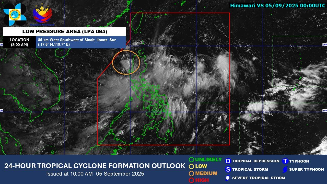
State weather bureau PAGASA said a low pressure area has formed west of Northern Luzon inside the Philippine area of responsibility (PAR) on Friday morning.
In an outlook, PAGASA, however, said the LPA inside PAR has a medium chance of becoming a tropical cyclone in the next 24 hours.
“As of 8:00 AM today, 05 September 2025, the cloud cluster west of Northern Luzon is now a Low Pressure Area (LPA 09a) and is being monitored inside the PAR,” PAGASA said.
“LPA 09a has a ‘MEDIUM’ chance to develop into a tropical depression within the next 24 hours,” it added.
PAGASA advised the public to monitor updates from the agency.
PAGASA earlier said the Southwest Monsoon or Habagat will bring cloudy skies with scattered rains over Luzon and the western section of the Visayas on Friday.
Metro Manila and the rest of Luzon will have cloudy skies with scattered rains and thunderstorms due to the southwest monsoon with the possibility that flash floods or landslides will occur due to moderate to heavy rains, PAGASA added.
Meanwhile, the weather bureau said Western Visayas will have partly cloudy to cloudy skies with isolated rain showers or thunderstorms due to the southwest monsoon and with flash floods or landslides occurring during severe thunderstorms.
The rest of the country will have partly cloudy to cloudy skies with isolated rain showers or thunderstorms due to localized thunderstorms with the possibility that flash floods or landslides will occur during severe thunderstorms, it added. — Joviland Rita/RSJ, GMA Integrated News
