

TD trough, Habagat to cause rains in Luzon – PAGASA
The trough of the tropical depression formerly named Lannie and the Southwest Monsoon (Habagat) will continue to bring rains over Luzon, state weather bureau PAGASA said Saturday.
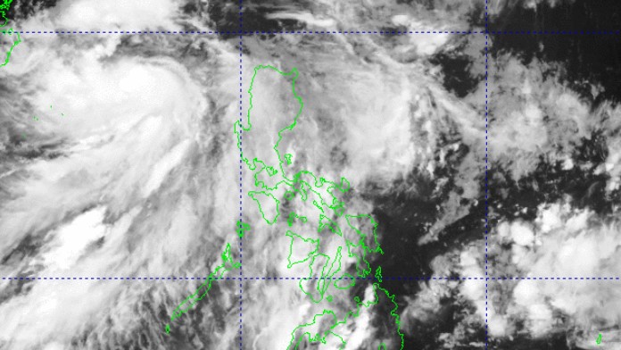
In its 4 p.m. bulletin, PAGASA said the tropical depression was already located 430 kms west of Sinait, Ilocos Sur—farther away from Luzon since it exited the Philippine Area of Responsibility (PAR) on Saturday morning.
The tropical depression carried maximum sustained winds of 55 kph and gusts of up to 70 kph as it moves west northwestward at 15 kph.
Due to the trough of the tropical depression, cloudy skies with scattered rains and thunderstorms may be expected over Ilocos Region, Cordillera Administrative Region, Nueva Vizcaya, and Quirino, while the rest of Cagayan Valley will have partly cloudy to cloudy skies with isolated rain showers or thunderstorms.
The Southwest Monsoon, on the other hand, will cause cloudy skies with scattered rains and thunderstorms in Metro Manila, Central Luzon, CALABARZON, Occidental Mindoro, Oriental Mindoro, and Marinduque.
According to PAGASA, a trough is an elongated area of low barometric pressure that generally stretches north and south.
Cloudy to cloudy skies with isolated rain showers or thunderstorms are expected over the rest of the country due to localized thunderstorms.
Flash floods or landslides may occur in some areas as a result of these weather conditions.
Meanwhile, moderate winds with moderate waters may be observed over Northern Luzon.
The rest of the country may feel light to moderate winds with slight to moderate coastal waters.
Sunrise in Metro Manila will be at 5:44 a.m. on Sunday. — VDV, GMA Integrated News
