

All storm warnings lifted as Mirasol exits PAR; Nando maintains strength
PAGASA has lifted all storm warnings after Tropical Depression Mirasol exited the Philippine Area of Responsibility (PAR) Thursday morning.
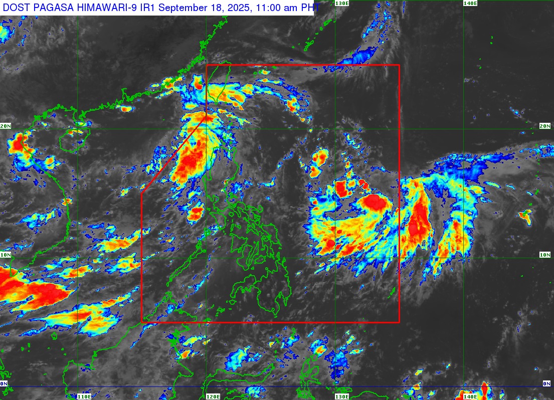
PAGASA said Mirasol was last spotted 395 km West of Calayan, Cagayan with maximum sustained winds of 55 km/h near the center, gustiness of up to 70 km/h, and central pressure of 1002 hPa.
Meanwhile, Tropical Depression Nando maintained its strength while moving slowly over the Philippine Sea. It was last spotted 1,335 km East of Southeastern Luzon with maximum sustained winds of 55 km/h near the center, gustiness of up to 70 km/h, and central pressure of 1004 hPa.
PAGASA said Nando "is less likely to directly affect the weather in the next 48 hours."However, Nando may potentially enhance the Southwest Monsoon as it approaches the landmass, and Wind Signal No. 1 will be hoisted over Northern Luzon as early as Saturday.
PAGASA added the Southwest Monsoon will bring strong to gale-force gusts over the following areas on Thursday:
- La Union
- Pangasinan
- Zambales
- Bataan
- Metro Manila
- Cavite
- Batangas
- Tarlac
- Pampanga
- Benguet
- MIMAROPA
- Quezon
- Bicol Region
- Western Visayas
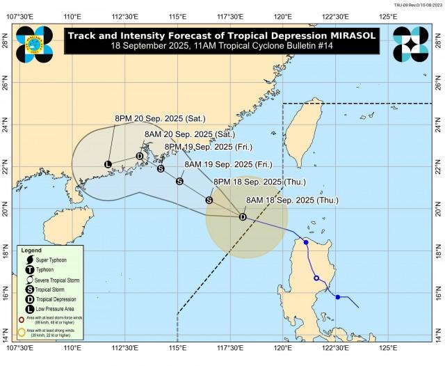
PAGASA also said that Tropical Depression Mirasol will continue moving generally northwestward towards southern China and may reach tropical storm category today.
"This weather disturbance will likely remain as a tropical storm throughout the forecast period before weakening as it makes landfall over southern China by Saturday (20 September)," PAGASA said.
"Considering these developments, the public and disaster risk reduction and management offices concerned are advised to take all necessary measures to protect life and property," added PAGASA. —VAL, GMA Integrated News
