

Paolo moves towards China; Gale-force gusts expected in parts of Luzon
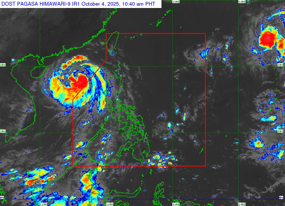
All Tropical Cyclone Wind Signals have been lifted Saturday morning as Severe Tropical Storm Paolo now moves towards China after exiting the Philippine Area of Responsibility.
However, PAGASA said in its 11 a.m. advisory that Paolo's outer rain bands will still bring strong to gale-force gusts in the following areas of northern Luzon:
Batanes, northern portion of mainland Cagayan including Babuyan Islands, Apayao, Zambales, and Bataan.
PAGASA also said that moderate to rough seas will also be over the following coastal waters:
Up to 3.0 m: The seaboard of Ilocos Region.
Up to 2.5 m: The seaboards of Batanes, Babuyan Islands, and Zambales.
Up to 2.0 m: The seaboards of mainland Cagayan, Isabela, and Bataan.
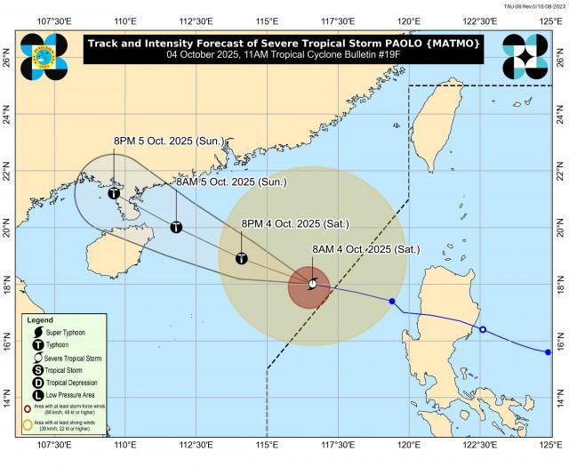
Paolo was last spotted 440 km West of Sinait, Ilocos Sur packing maximum sustained winds of 110 km/h near the center and gustiness of up to 135 km/h.
PAGASA said Paolo will continue moving west northwestward towards southern China. It added that while moving over the West Philippine Sea, Paolo may re-intensify into a typhoon on Saturday.
Meanwhile, in its Storm Surge Warning issued at 8 a.m., PAGASA said the threats of storm surges have ceased after STS Paolo exited PAR.
“Threats for storm surge to affect Philippine coastal areas have CEASED as TC PAOLO’s areas of maximum winds are now offshore and continue to move farther away from the Philippine landmass. However, wind-driven waves may still affect low-lying coastal communities,” it said. —VAL, GMA Integrated News
