

Ramil strengthens outside PAR but will still bring gale-force gusts over PH
Tropical Storm Ramil (international name: Fengshen) intensified while outside the Philippine Area of Responsibility (PAR) on Monday but will still bring strong to gale-force gusts over some areas, PAGASA said.
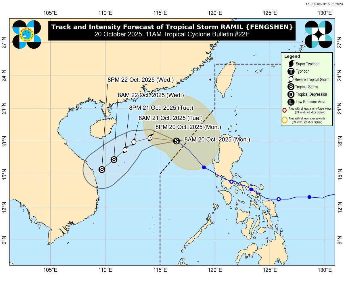
Ramil exited PAR at 8 a.m., the weather bureau said.
At 10 a.m., Ramil's center was estimated to be located at 440 km west of Sinait, Ilocos Sur, packing maximum sustained winds of 85 km/h, gustiness of up to 105 km/h, and with central pressure of 992 hPa.
Ramil is moving northwestward at 25 km/h .
From its center though, strong to gale-force winds are extending outwards up to 450 km.
"The trough and outer rainbands of RAMIL and the easterlies will also bring strong to gale-force gusts over the following areas (especially in coastal and upland areas exposed to winds): Ilocos Region, Cordillera Administrative Region, Cagayan Valley, Central Luzon, and Occidental Mindoro," PAGASA said.
Meanwhile, no more Tropical Cyclone Wind Signals were in effect.
Coastal waters
PAGASA said coastal waters will be rough over the northwestern seaboard of Ilocos Norte and the western seaboard of Pangasinan. These areas may have waves up to 3.0 meters.
"Mariners of small seacrafts, including all types of motorbancas, are advised not to venture out to sea under these conditions, especially if inexperienced of operating ill-equipped vessels," it said.
Up to moderate seas meanwhile were forecast for the following coastal waters:
• Up to 2.5 m: The seaboards of Batanes, Cagayan including Babuyan Islands, Isabela, and Zambales; the western seaboard of Pangasinan; the remaining seaboards of Ilocos Norte; and
• Up to 2.0 m: The seaboards of Ilocos Sur, La Union, and Aurora; the northern seaboards of Camarines Norte and Camarines Sur; the northern and eastern seaboards of Catanduanes; the western seaboard of Bataan; the remaining seaboards of Pangasinan.
"Mariners of motorbancas and similarly sized vessels are advised to take precautionary measures while venturing out to sea and, if possible, avoid navigation under these conditions," PAGASA said.
Track, intensity
The weather bureau said Ramil will move northwestward to westward on Monday then turn west southwestward to southwestward on Tuesday early morning.
The storm is seen to intensify and become a severe tropical storm within the next 12 hours.
Casualties
Seven people were reported dead due to the impact of Ramil, according to the Office of Civil Defense (OCD) on Monday.
In its report at 6 a.m. on Monday, the National Disaster Risk Reduction and Management Council (NDRRMC) said five of the fatalities were reported in Calabarzon while the other two in Western Visayas.
One person was reported injured in Calabarzon, according to the NDRRMC.
Two people meanwhile were reported missing in Eastern Samar, the OCD said. Search and rescue operations are ongoing to find them.
Based on the NDRRMC report, a total of 133,196 people or 37,825 families in Cagayan Valley, Central Luzon, Western Visayas, and Eastern Visayas were affected by Ramil.
Of the total affected population, the NDRRMC said 7,511 people or 2,260 families were staying inside evacuation centers, while 6,199 people or 1,720 families were taking shelter in other places. —KG, GMA Integrated News
