

PAGASA: LPA off Batanes has 'medium' chance of becoming tropical depression
The low pressure area spotted off Batanes now has a “medium” chance of developing into a tropical depression in the next 24 hours, the state weather bureau said on Tuesday night.
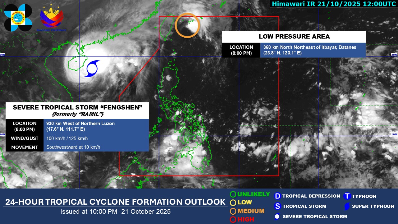
In its 10 p.m. advisory on Facebook, the Philippine Atmospheric, Geophysical, and Astronomical Services Administration said it is monitoring the low pressure area, which is now inside the Philippine Area of Responsibility.
It has inched closer to the country and was spotted 360 kilometers north northeast of Itbayat, Batanes as of 8 p.m. Tuesday.
PAGASA said the low pressure area has a medium chance of developing into a tropical depression and advised the public to constantly monitor weather bulletins and updates.
Meanwhile, Severe Tropical Storm Fengshen (formerly Ramil) is still being monitored outside the PAR. It is now 930 kilometers west of Northern Luzon.
In its earlier 4 p.m. public weather forecast, PAGASA said the Intertropical Convergence Zone (ITCZ) will bring cloudy skies and rains over parts of Visayas and Mindanao.
The Negros Island Region, Central Visayas, Zamboanga Peninsula, Northern Mindanao, SOCSSKARGEN, BARMM, and Davao Region will experience cloudy skies, scattered rains and thunderstorms due to the ITCZ.
Meanwhile, the Bicol Region, Eastern Visayas, Caraga, Aurora, and Quezon will have partly cloudy to cloudy skies with isolated rain showers or thunderstorms due to the easterlies.
Batanes will experience partly cloudy to cloudy skies with isolated rain showers or thunderstorms due to the northeasterly windflow. — JMA, GMA Integrated News
