

Potential super typhoon to enter PAR Friday or Saturday - PAGASA
The state weather bureau PAGASA is monitoring a potential super typhoon that will enter the Philippine Area of Responsibility later this week.
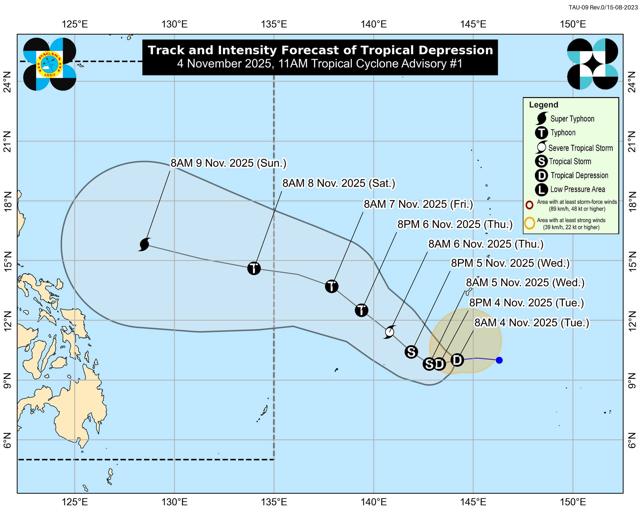
On Tuesday, PAGASA said the weather disturbance, currently a tropical depression, was located 1,985 km east of Northeastern Mindanao at 10 a.m. It was moving westward at 20 km/h, with maximum sustained winds of 55 km/h near the center and gustiness of up to 70 km/h.
The tropical cyclone will be identified as Uwan, according to PAGASA, once it enters the PAR, possibly on Friday night or Saturday.
PAGASA said the tropical cyclone would intensify into a super typhoon during the weekend, with maximum sustained winds exceeding 185 km/h.
"Although not yet within the forecast range of this advisory, the TC Threat Potential Forecast from PAGASA indicates that the possibility of a landfall scenario over the country is becoming more likely. However, the exact landfall location and time remain highly uncertain, considering that the forecast is more than five days ahead," PAGASA said.
Starting on Saturday, the Philippines' northern and eastern seaboards are expected to see rough seas or worse, it added.
Typhoon Tino is currently affecting parts of Visayas and Luzon. Tino will leave the PAR either Wednesday night or early Thursday morning. —VBL, GMA Integrated News
