

Verbena weakens, no wind signals raised
Typhoon Verbena weakens while slowly moving in the west southwest direction late Thursday evening, according to the latest Tropical Cyclone Bulletin posted by PAGASA.
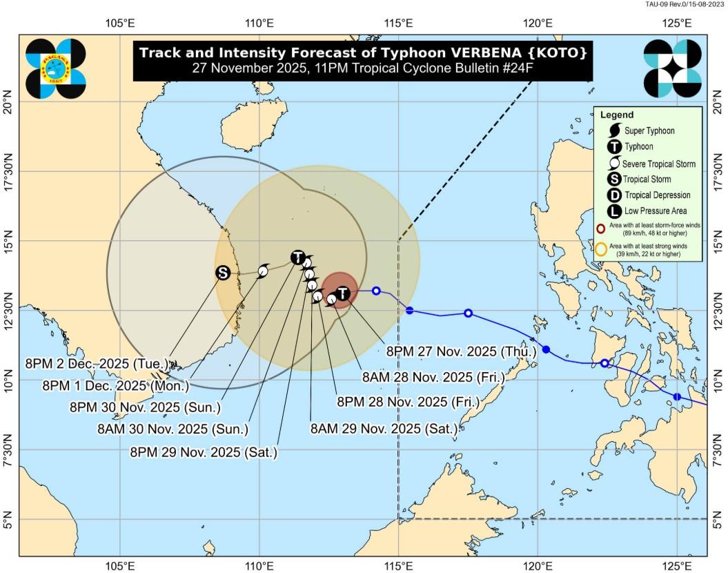
The center of the typhoon was estimated at 270 kilometers Northwest of Pag-asa Island, Kalayaan, Palawan outside the Philippine Area of Responsibility (PAR), packing maximum sustained winds of 120 kilometers per hour near the center, gustiness of up to 150 km/h, and central pressure of 975 hPa.
Verbena is moving west southwestward slowly with strong to typhoon-force winds extending outwards up to 550 km from the center.
There are no wind signals currently hoisted, the state weather bureau said.
Severe Winds
PAGASA also reported that the surge of Northeast Monsoon and the periphery of Verbena, however, will bring gusty conditions reaching strong to gale-force strength over the following areas (especially in coastal and upland areas exposed to winds) over the following areas: Batanes, Cagayan, Apayao, Abra, Ilocos Norte, Ilocos Sur, Zambales, Bataan, Occidental Mindoro, and Palawan.
A Gale Warning is in effect over the seaboards of Northern Luzon and the western seaboard of Southern Luzon. Mariners are advised to take precautionary measures while venturing out to sea and, if possible, avoid navigation under these conditions.
Track and Intensity outlook
Typhoon Verbena is forecast to move slowly throughout the forecast period, said PAGASA.
"On the track forecast, it will move west southwestward tonight, westward or west northwestward tomorrow (28 November), generally north northwestward during the weekend (29 to 30 November), then west southwestward or westward towards Vietnam for the remainder of the forecast period."
Verbena will slightly weaken over the next 48 hours and may be downgraded into a severe tropical storm by Friday. — BAP, GMA Integrated News
