

ADVERTISEMENT
Filtered By: Topstories
News
Typhoon Lawin weakens but still headed for Batanes-Cagayan
Typhoon Lawin (Jelawat) weakened slightly early Thursday as it continued to move toward the Batanes-Cagayan area in Northern Luzon early Thursday.
But PAGASA warned residents of areas in Northern Luzon not to underestimate the supposedly weakened Lawin, which it said is still considered very powerful.
"Bahagyang humina si Lawin pero hindi porke't humina si Lawin lalo sa extreme Northern Luzon ay magkumpiyansa na tayo, napakalakas pa nito (Lawin slightly weakened but that does not mean residents especially in extreme Northern Luzon can relax. It is still very powerful)," PAGASA forecaster Gener Quitlong said in an interview on dzBB radio. 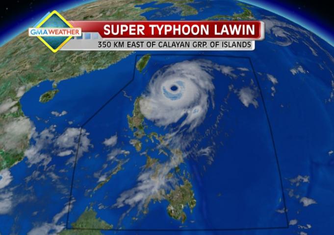
Satellite image of Typhoon Lawin as of 7 a.m., Sept. 27
He said Lawin particularly poses a threat to fishermen and small seacraft in the eastern seaboards of Luzon and Visayas as it can generate big waves.
Quitlong also said their models indicate Lawin may remain in the Philippine Area of Responsibility until at least Saturday morning, given its "slow" 13 kph speed.
On the other hand, he said that while there is little chance of Lawin making landfall, it may be felt especially in the Batanes area.
Earlier, PAGASA had indicated the possibility of Lawin making landfall over the northern tip of Cagayan, but it also said Lawin may pass between Cagayan and Batanes.
"Kahit di tatama ang sentro naroon pa rin sa eye wall kaya di ma-distinguish, para kayong nasa sentro lalo sa Batanes (Even if the center of Lawin is not likely to make landfall, the eye wall may hit Batanes, so people there may feel they are at the center of the storm)," he said.
PAGASA's 5 a.m. advisory indicated Lawin was 350 km east of Calayan Islands as of 4 a.m., with maximum sustained winds of 205 kph near the center and gustiness of up 240 kph.
It was moving northwest at 13 kph and is expected to be 125 km northeast of Itbayat, Batanes Friday morning, and 185 km east of Taiwan Saturday morning.
By Saturday afternoon it is expected to be 260 km northeast of Okinawa, Japan.
Under Storm Signal No. 2 are Batanes, Cagayan, Calayan, and Babuyan Islands. Under Signal No. 1 are Ilocos Norte, Kalinga, Apayao, Abra, and Isabela.
"Residents living in coastal areas under public storm warning signal #2 are alerted against big waves or storm surges generated by this typhoon," PAGASA said.
PAGASA said Cagayan, Calayan, Babuyan and Batanes Islands will experience stormy weather with rough to very rough seas.
Abra, Ilocos Norte, Kalinga, Apayao and Isabela will have rain and gusty winds while Metro Manila and the rest of Luzon and Visayas will experience cloudy skies with occasional light to moderate rain and thunderstorms.
Mindanao will have partly cloudy to cloudy skies with occasional light to moderate rain or thunderstorms.
Moderate to strong winds blowing from the northeast to northwest will prevail over Central Luzon, Nueva Vizcaya and Quirino and coming from the southwest over Southern Luzon, Visayas and Mindanao and the coastal waters along these areas will be moderate to rough.
PAGASA said Lawin may bring rainfall of 10 to 25 mm per hour (heavy to intense) within its 800-km diameter.
PAGASA said the eastern seaboard of Central and Southern Luzon (Aurora, Quezon Province, Bicol, Camarines Provinces, Catanduanes and Albay) may experience cloudy skies with occasional light to moderate rain and thunderstorms.
It added the western and southern seaboards of Southern Luzon (Batangas, Cavite, MIMAROPA) and the seaboards of Visayas will have cloudy skies with occasional light to moderate rain and thunderstorms.
"Fishing boats and other small seacrafts are advised not to venture out into the sea while larger sea vessels are alerted against big waves," it said. — TJD/ELR, GMA News
