

 GMA Brandtalk
 Tracking
 Archives

Tropical Storm Pilandok may exit PAR early Thursday
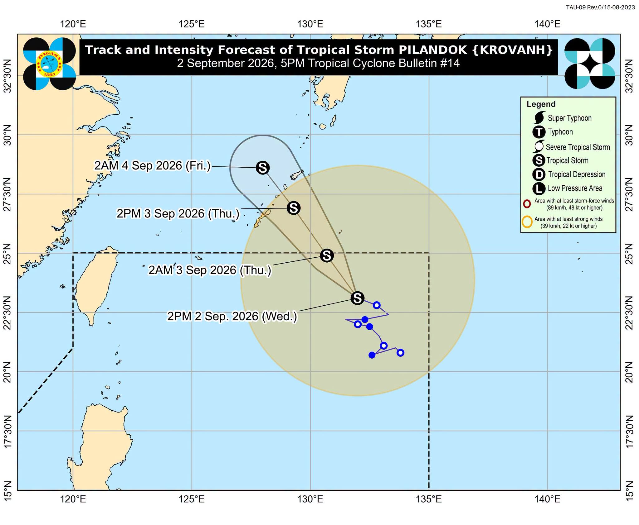
Tropical Storm Pilandok is expected to leave the Philippine Area of Responsibility (PAR) early Thursday morning, the state weather bureau PAGASA said Wednesday afternoon.
At 4 p.m., Pilandok was located 1,085 kilometers east-northeast of Extreme Northern Luzon, packing maximum sustained winds of 65 kilometers per hour near the center and gustiness of up to 80 km/h.
It was moving west-northwestward at 15 km/h.
Pilandok is not expected to directly influence the country’s weather, while the Southwest Monsoon, or Habagat, will continue to affect Luzon and the Visayas, PAGASA said.
Occasional rains are expected over the Ilocos Region, Abra, Benguet, Zambales, and Bataan.
Metro Manila, Cagayan Valley, the rest of the Cordillera Administrative Region, the rest of Central Luzon, Cavite, Batangas, Rizal, and Occidental Mindoro will experience cloudy skies with scattered rains and thunderstorms.
The Visayas and the rest of Luzon will have partly cloudy to cloudy skies with isolated rain showers or thunderstorms.
Mindanao will experience localized thunderstorms.
PAGASA warned that moderate to heavy rains and severe thunderstorms could trigger flash floods and landslides.
The Southwest Monsoon will also bring strong to gale-force gusts to the following areas, particularly in coastal and upland areas exposed to winds:
Wednesday to Friday: Most of Luzon and the Visayas, Zamboanga del Norte, Misamis Occidental, Lanao del Norte, Misamis Oriental, Camiguin, Dinagat Islands, Davao Occidental, and Davao Oriental. — with Jean Mangaluz/VBL, GMA News

