

 GMA Brandtalk
 Tracking
 Archives

Queenie slightly intensifies as it moves northwest
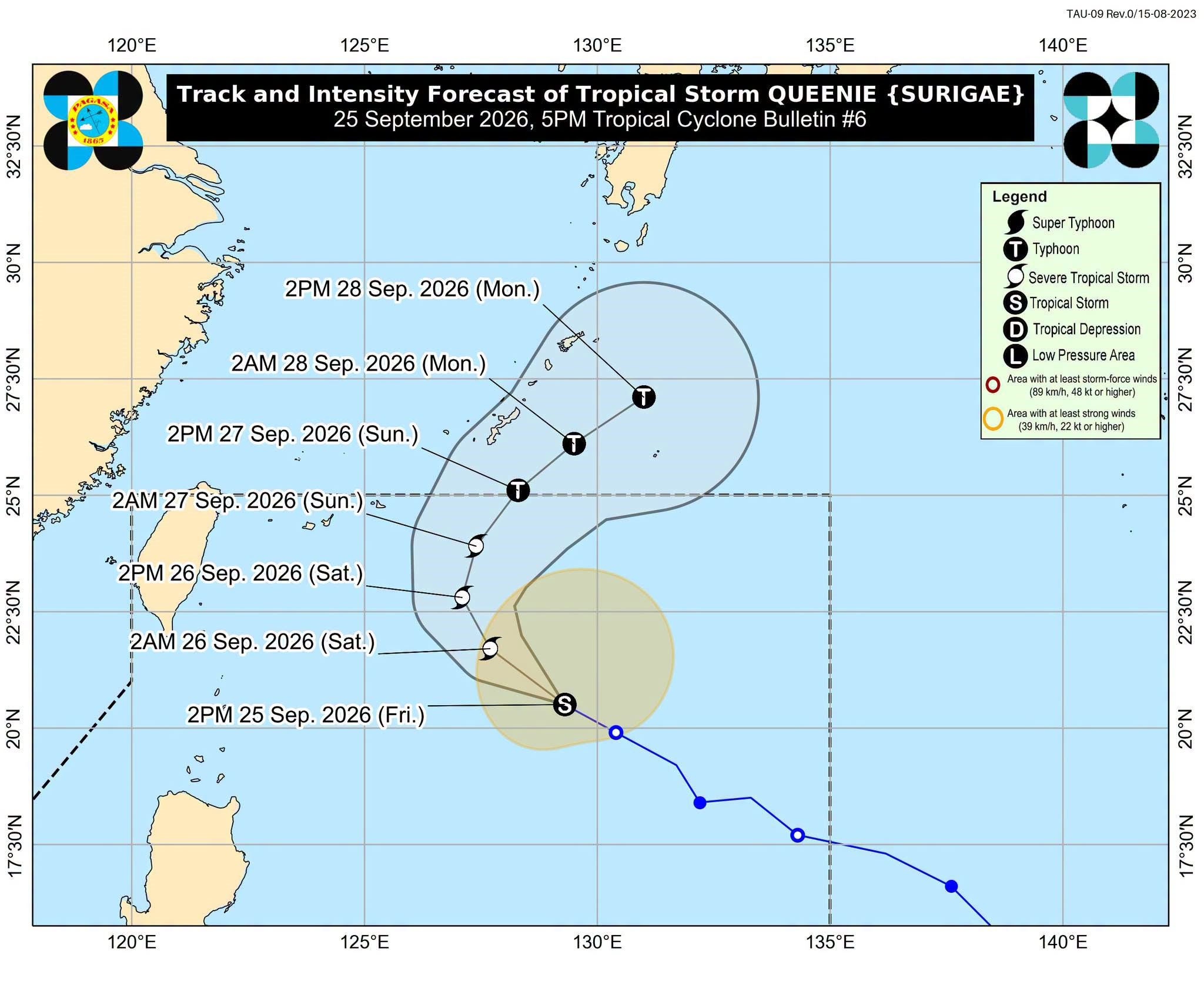
Tropical Storm Queenie (international name: Surigae) slightly gained strength as it moved west northwestward over the Philippine Sea, according to state weather bureau PAGASA on Friday.
The weather disturbance was unlikely to directly impact the country, although it may eventually reach typhoon strength, the agency said.
In its 5 p.m. cyclone bulletin, PAGASA said Queenie will move northwestward before moving northwestward anew on Saturday morning.
Queenie currently has maximum sustained winds of 85 kph near the center and gusts of up to 105 kph. It is currently located 745 kms east of Basco, Batanes.
Queenie is set to leave the Philippine Area of Responsibility (PAR) by Sunday afternoon or evening.
Before leaving PAR, However, Queenie will likely intensify into a typhoon.
PAGASA did not hoist any tropical cyclone wind signal warning over the country.
Meanwhile, PAGASA said in a separate advisory that Negros Island Region, Central Visayas, Zamboanga Peninsula, Northern Mindanao, Caraga, Davao Oriental, and Basilan are forecast to experience cloudy skies and scattered rais due to the Intertropical Convergence Zone. — VDV, GMA News

