

 GMA Brandtalk
 Tracking
 Archives

Super Typhoon Champi still outside PAR, could enter Tuesday - PAGASA
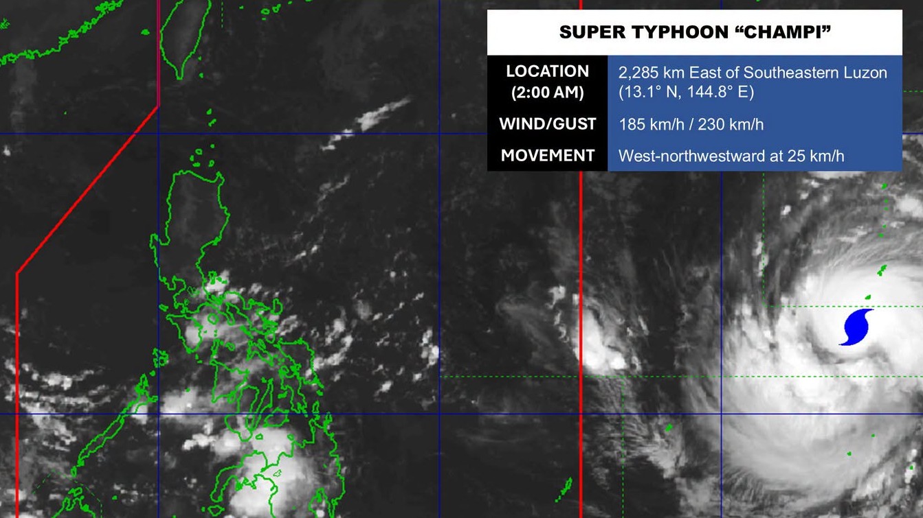
Super Typhoon Champi (international name) remains outside of the Philippine Area of Responsibility (PAR) and could possibly enter by Tuesday.
Champi was last monitored 2,230 kilometers east of Southeastern Luzon, PAGASA weather specialist Dan Villamil told Super Radyo dZBB on Sunday morning.
It has maximum sustained winds of 185 kilometers per hour near the center, and gustiness of up to 230 kilometers per hour.
It is moving west northwestward at 25 kilometers per hour, Villamil added.
PAGASA said Champi won't affect the country yet while still outside PAR.
But once it enters PAR by Tuesday, Villamil said that Champi could affect most parts of northern Luzon towards the end of the week. Rains are also expected over parts of Cagayan Valley and the northern portion of Ilocos Region.
For the meantime, PAGASA said that the Intertropical Convergence Zone (ITCZ) will bring cloudy skies with scattered rains and thunderstorms over parts of Mindanao and Palawan on Sunday.
Meanwhile, Metro Manila and the rest of the country will experience partly cloudy to cloudy skies with isolated rain showers or thunderstorms. —Vince Angelo Ferreras/RF, GMA News

