

 GMA Brandtalk
 Tracking
 Archives


Super Typhoon Rosal speeds up; 7 areas under Signal No. 1
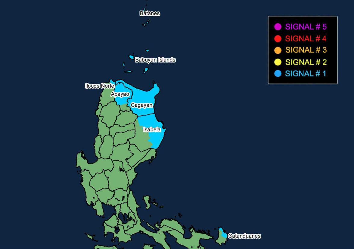
Super Typhoon Rosal accelerated over waters east of Northern Luzon, prompting the raising of wind signals in more areas.
As of 5 a.m. on Wednesday, the following are under Signal No. 1:
- Batanes
- Babuyan Islands
- Mainland Cagayan
- The eastern portion of Isabela (Maconacon, Divilacan, Palanan, Santa Maria, Cabagan, Delfin Albano, Santo Tomas, Tumauini, San Pablo, Ilagan City, San Mariano, Dinapigue)
- The northern and central portions of Apayao (Calanasan, Luna, Santa Marcela, Flora, Pudtol, Kabugao)
- The northeastern portion of Ilocos Norte (Pagudpud, Adams)
- The northeastern portion of Catanduanes (Pandan, Bagamanoc, Panganiban, Viga, Gigmoto)
Winds of 39-61 kilometers per hour may be expected in at least 36 hours, or intermittent rains may be expected within 36 hours in these areas.
The center of the eye of Rosal was estimated at 990 km east of Northern Luzon, moving west northwestward at 30 km/h. It has maximum sustained winds of 215 km/h near the center and gustiness of up to 265 km/h.
Heavy rainfall outlook
Forecast rainfall for the areas affected by the super typhoon is as follows:
Wednesday, October 21
(50-100 mm):
Ilocos Norte, Apayao, and Cagayan
Thursday, October 22
(100-200 mm):
Batanes
(50-100 mm):
Ilocos Norte, Apayao, and Cagayan
Friday (October 23)
(50-100 mm):
Batanes
"Forecast rainfall may be higher in mountainous and elevated areas. Moreover, impacts in some areas may be worsened by significant antecedent rainfall," PAGASA said.
Track
The super typhoon will continue moving west northwestward Wednesday, then northwestward until Friday (23 October) morning, before recurving northeastward by Sunday (25 October).
On the forecast track, PAGASA said the tropical cyclone will be closest to extreme Northern Luzon between Thursday and Friday afternoon. It will exit the Philippine Area of Responsibility by Friday evening or Saturday (24 October) early morning.
"Further intensification remains possible within the next six hours as Rosal moves over the Philippine Sea before a weakening trend begins. It is forecast to weaken into a typhoon Thursday and into a severe tropical storm by Sunday," PAGASA said. —LDF, GMA News

