

 GMA Brandtalk
 Tracking
 Archives


Typhoon Rosal slightly weakens; Signal No. 2 up over Batanes, parts of Babuyan Islands
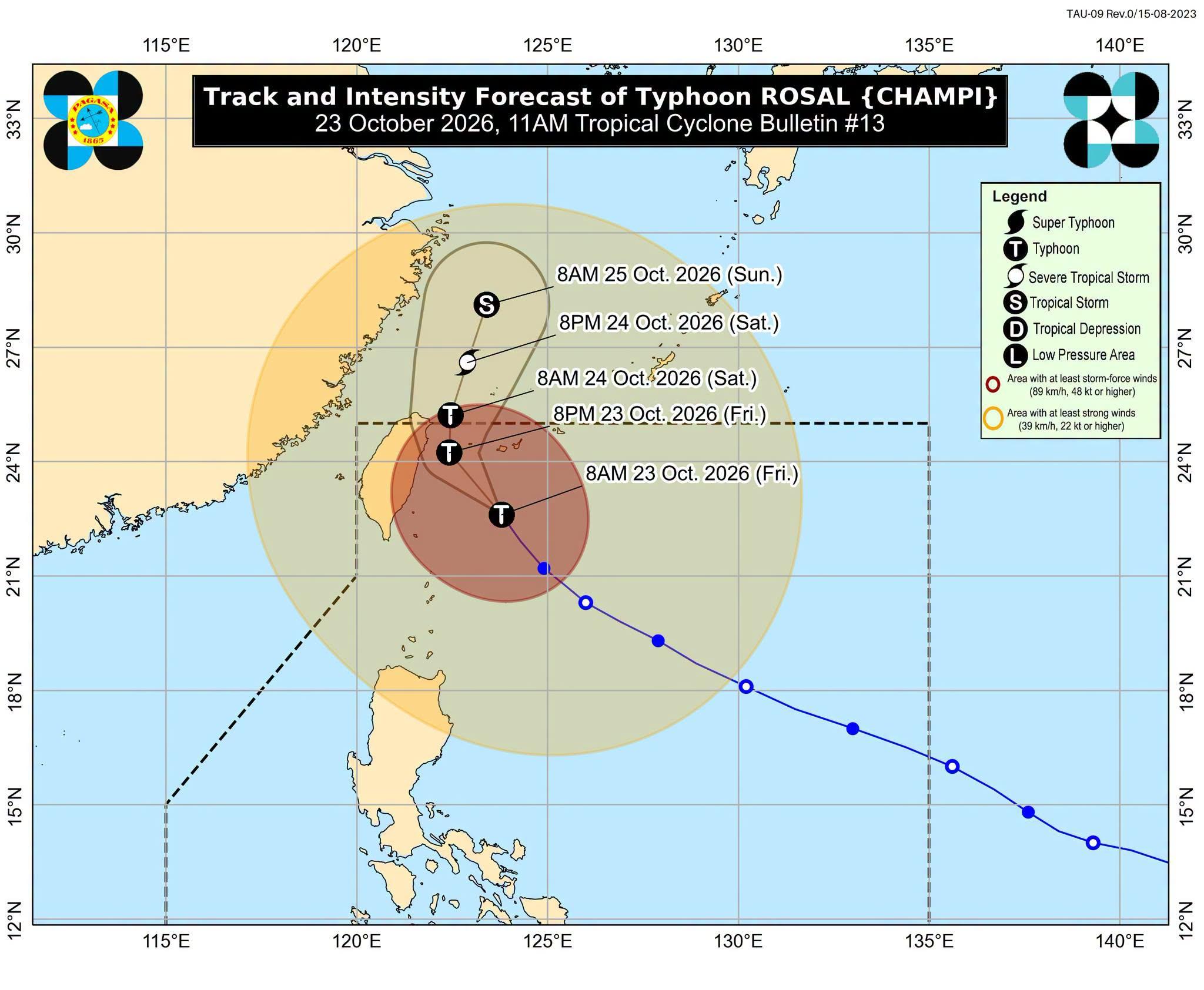
Typhoon Rosal has slightly weakened, but Wind Signal No. 2 remains in effect over Batanes and the northeastern portions of the Babuyan Islands, state weather bureau PAGASA said Friday.
In its 11 a.m. bulletin, PAGASA said Rosal has slightly weakened while moving north-northwestward over the sea east of Taiwan.
As of 10 a.m., Rosal was estimated at 305 kilometers northeast of Itayat, Batanes, packing maximum sustained winds of 150 kilometers per hour near the center and gustiness of up to 185 kilometers per hour.
Wind Signal No. 1 has also been raised over the rest of the Babuyan Islands, mainland Cagayan, Ilocos Norte, and Apayao.
The periphery of Rosal is also expected to bring strong to gale-force gusts over most of Luzon and Visayas, Zamboanga del Norte, Misamis Occidental, Lanao del Norte, Camiguin, Davao Occidental, and Davao Oriental.
Rosal is forecast to exit the Philippine Area of Responsibility by Saturday morning.
“Rosal will continue moving generally northwestward until tonight before moving northward then north-northeastward between tomorrow (24 October) and Sunday (25 October),” the state weather bureau said.
The typhoon is expected to weaken gradually within 24 hours.
PAGASA said Typhoon Rosal may be downgraded to a severe tropical storm by Saturday afternoon or evening, and is likely to weaken further into a tropical storm by Sunday morning.
The state weather bureau still advised the public and concerned disaster risk reduction and management offices to take all necessary measures to protect property and life. — RSJ, GMA News

