

Signal No. 1 still up over Batanes as Carina moves northward
Tropical Cyclone Wind Signal (TCWS) Signal No. 1 is still up over Batanes as Tropical Depression Carina moved northward, state weather bureau PAGASA said Tuesday.
In its 8 a.m. severe weather bulletin, PAGASA said Carina will bring scattered light to moderate rains with at times heavy rain showers over Batanes, Babuyan Islands, and Ilocos Norte.
Due to this, PAGASA warned of flooding and rain-induced landslides during heavy or prolonged rainfall especially in areas that are highly or very highly susceptible to these hazards.
In the next 24 hours, moderate to rough seas (1.2-3.1 m) will be experienced over the seaboards of Northern Luzon. Those with small seacrafts are advised not to venture out to sea, PAGASA advised.
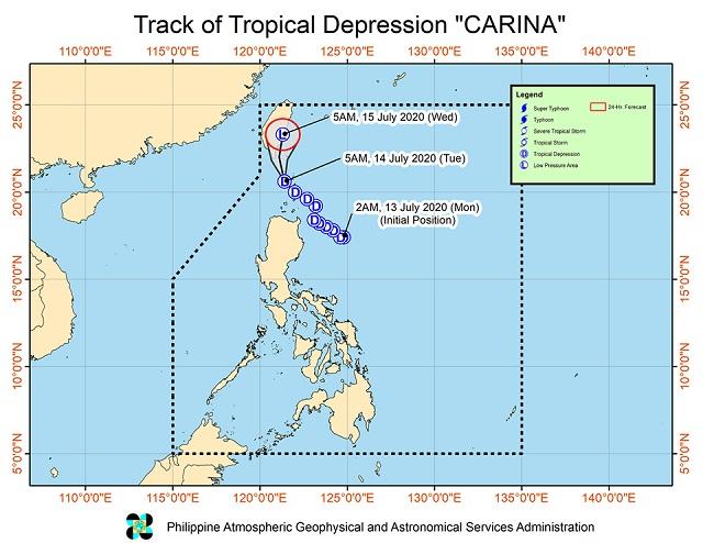
“It is forecast to weaken into a Low Pressure Area today or tomorrow morning,” PAGASA said.
At 7 a.m., PAGASA said Carina was located at 95 kilometers west northwest of Basco, Batanes with maximum sustained winds of 45 km per hour and gustiness of up to 55 km per hour moving northwest at 25 km per hour.
According to PAGASA, Carina is expected to turn northward while heading towards the Bashi Channel and the southern portion of Taiwan.
Reports on Unang Balita on Tuesday said Carina caused heavy rain and strong winds in many northern Philippine provinces on Monday, resulting in minor flooding and, in one case, a landslide.
According to Bam Alegre's report, some commercial areas in Aparri, Cagayan were flooded. In other areas of the province such as Bugey and Tuguegarao, persistent rains inconvenienced many motorists.
Heavy rains were also experienced in Bontoc, Mountain Province.
A separate report by GMA News stringer Dennis Alipio said a landslide occurred on a main road in Pagudpud, Ilocos Norte due to the bad weather. Government personnel are already in the area to clear the road. —Joviland Rita/KBK, GMA News
